Monday, January 27, 2020

The Water Hole - WI3, 45m and Irish Mist - WI3, 65m

View up The Water Hole.
Fun thin left side and the main right side flow.

Just east of Canmore, about 15 km east, the Trans Canada Highway takes a big curve between Lac Des Arcs and Mt. McGillivary.  On the outlier of Mt. McGillivary is long wall with some older rock routes (McGillivary Slabs), a couple of new rock routes and a couple of cool moderate ice climbs; “The Water Hole” and “Irish Mist”. These ice routes were first climbed way back in the 1970’s, and, interesting to me; during my peak of ice climbing (1995 to 2000), these routes were rare to form, often not really forming in some seasons. But lately, since maybe 2010, they both seem to form up every season?  Both routes are WI3, and back in the 1990’s, didn’t seem to be worth my time, so I have never climbed them.  Not being a tough ice climber anymore, it was time to give them a visit.

Old School at the base of The Water Hole.
(Photo by Laurie)
Laurie and I headed to these fine little routes on January 24 for his second ever time ice climbing. Warm day, high near +6 or so, but both these routes are in the shade all day. We parked on the westbound side of the Trans Canada and there was one car parked with “Water Hole” and “Irish Mist” written in grime on the back trunk, I thought, two routes, no problem. We easily crossed the highway and followed the very ice packed trail to the base of Irish Mist.

The other party was a group of two, a guide (Jay Mills) and his client from Mexico, they had setup a top rope on the bottom half of Irish Mist, and then planned to do some rock/mixed climbing near the top of the route; Jay indicated that they would be awhile, but The Water Hole was clear. I was glad this group was only two, we happily headed to the other route.

Laurie at the base of The Water Hole.

The Water Hole was cool, two separate lines and about 50 metres high. I led the right side first, casual WI3, or even WI2+, fun climb with good ice quality, topped out and found a bolted station far to climbers right. Brought up Laurie and we did a double rope rappel back to the base of the route. Next, I led the left side line, super fun, more challenging, definitely a solid WI3, good fun. Near the top out, there a tree to the left will lots of new cord. A little awkward to reach the tree, but nothing too bad. 

OSWB leading up the right side of The Water Hole.
(My left line is visible on the left)

Higher up on The Water Hole.

LK nearing the belay on the top of right side of The Water Hole.

Brought up Laurie, then rap back to the base.  We pack up and were wondering about ours on Irish Mist, when Jay and client started up the hill towards, perfect time. 

LK rapping off the right side top bolted station.

LK rapping off the tree on the left side.


OSWB rapping on the left side of The Water Hole.
(photo by Laurie)

Short hike back to Irish Mist and we set up for the climb.  A couple of small pillars formed off some fairly tall overhangs, but these short pillars were so picked and stepped out, they were a ladder.  Fun easy WI3, or even WI2+, to a bolted station, a full 55 metres. Brought up Laurie, then rap back to the base. Good fun. 

OSWB leading up Irish Mist.
(photo by Lauire)

Looking down from about half way up Irish Mist.


OSWB leading the top of Irish Mist.
(photo by Laurie)

Great to check out these fun little routes and enjoy some warm weather in January.


Nice looking buttress on the South East end of Grotto Mtn.
Nice evening light.


Wednesday, January 22, 2020

Ski tour to Fryatt Hut (Sydney Vallance Hut)

A last minute sort of trip, January 11 to 13 I joined up with John L. and Colin B. for a ski trip to the cozy Fryatt Hut, or officially called, the Sydney Vallance Hut. The forecast called for very cold weather starting Sunday, highs near -30 and lows, well colder. We drove up Friday night and slept in Colin’s cool van in the Athabasca parking lot, not too cold, about -20. Drove to the Athabasca river crossing on Saturday (Jan. 11) morning, close to the Kerkeslin Campground, about 50 km south of the Jasper townsite.

Colin's cool van Saturday morning at the Athabasca parking lot. 
Plenty of room for three big guys. 
John had been to the hut several times in the summer and knew where to cross the hopefully frozen Athabasca River. Crossing on the frozen river saves about 7km off the regular summer hike.  From the river crossing, it is about 16km to the hut.  We found a well packed trail all the way to the hut.  A group of 5 was registered to be at the hut. Just before the hut, there is a steep headwall, thankfully the trail was well packed and mostly easy travel.  There is about 750 metres of elevation gain to the hut. After the river crossing, it is flat for much of the trip, then a short gradually up hill to an open valley that ends in the headwall.


John checking out the river crossing, yeah, it looks good.

View up stream, open water is visible.

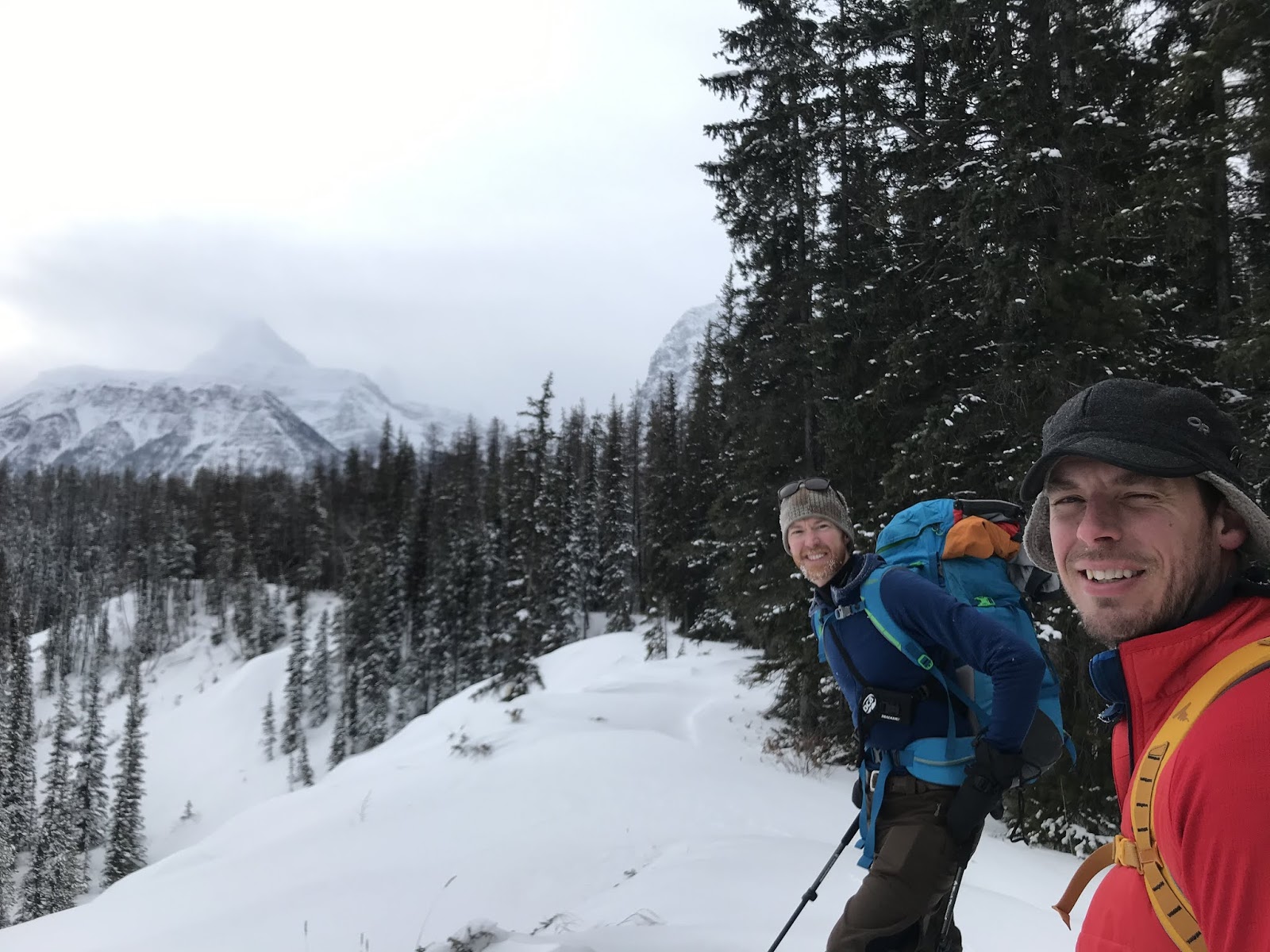
John and Colin enjoying the ski in.

Snowy trees as we gain elevation.
Open valley above the first campground and first section of real elevation gain.
The headwall is at the end of the valley, took longer than we thought to reach it.

View back towards the highway from this open valley.

We arrived at the hut in 6 hours. The hut was very busy with the 5 other people, felt like we could barely fit, the other group had their stuff spread out everywhere.  Would hate to be at this hut with a full house of 12 people. Sunday morning the other group of 5 dudes left and we had the hut to ourselves.  In the afternoon, John and I did a 3 hour tour above the hut, explored the ice cave and got some turns and some exercise, then back to warm hut. 

The cute little hut. 


Hut interior pano shot.  Great for 3 people.

John just inside the ice cave.
View inside the cave, seemed to continue for a ways, but crampons were a must.


View from the cave.

John and I did a few laps in these trees, okay skiing, 
but anything else was very steep open alpine and a bit scary.

View in the alpine, not the best visibility.

South East end of the South East Ridge of Mt. Belanger.

Monday morning (Jan. 12) was cold, about -38? (couldn't really get an accurate reading on the thermometer), so we made quick time on our ski to avoid lingering in the cold, 4 hours out to the van.  Great weekend with some young guns. 


-38 ish

Great view to Mt. Brussels. 

Lets ski.

Skiing across the small lake below the headwall.

View back across to the headwall.

View south (Sunwapta Peak on the far horizon).

Saturday, December 14, 2019

B2 (Upper ETC) - WI 3, 25m

December 6 took my good friend Laurie out for his very first ice climbing. Laurie has only been alpine and multi pitch sport climbing for a relatively short time; about 5 years. In fact, our first alpine climb together was in July 2014 when we did the first known ascent of "Rocky Peak" (GR334290) via West Face/Ridge with alpine climbing in the 5.4 range. Laurie is a solid 5.10 bolt protected climber and usually about 5.8 trad lead climber, depending on the ease of getting trad pro. He is a strong and brave rock leader, so I knew he would have no problem with ice climbing. 


Laurie at the end of the day, WD40 in the background.

Back in 2008, Jason Wilcox and I set three new ice routes in Upper Evan-Thomas Creek. The ice route "B2" I climbed with Tony Barton in March of 1995; at the time we assumed we had climbed "Good H'evans Thomas". I had top roped "WD40" twice in January of 2006, didn't have the head space to lead it that year, so Jason and I led the route in January of 2008, the first ascent documented year. Some details on Upper Evan-Thomas Creek in these links.

My Summitpost page for Evan-Thomas Creek Ice Climbs

My January 2008 Gravsports Trip Report

Since 2008, Upper Evan-Thomas Creek has become quite popular, busy and well trodden. So well trodden, that the once small goat path on the upper bank of the creek that avoids the tight canyon just upstream of Combo Falls has been massive widened and now includes wooden handrails on the trees, and the relatively easy, but exposed, rock traverse in the narrow canyon has a steel cable handrail added (I think added in 2017 or 2018).  I had thought about chopping this handrail, but it does increase safety, I guess you are a wimpy rock scrambler, you use the hand rail, if not, then don't use. I didn't use the handrail on my trip with Laurie. 

Being a Friday, I assumed we would have upper ETC to ourselves, nope, including us, a total of 11 people between B2 and Green Monster before noon. Oh well, the way of the world I guess. There was a guided group ahead of us that we caught up to, at first the guide considered B2, so I thought Slurpee might be in shape, nope, wasn't formed well. I thought about Green Monster, but I haven't lead much in the last couple of season, so back to B2. The guided group was sharing a top rope with another group of 4 on WD40.

Busy day, view to WD40.

Slurpee was no formed. Didn't bother. 

View back to Green Monster. Seriously considered a lead up it, but I glad I didn't. 

LK enjoying the brisk temps.
Simple lead to the top of B2, I set up a top rope and Laurie did a pile of laps on the top rope.  I gave Laurie a history of ice climbing techniques and the option of climbing with or without leashes since I have two pairs of tools (Quarks from 1999 with leashes and Nomics from 2012). Spent a couple hours of pleasant ice climbing; Laurie loved it. After dark, i did the last lap and clean the anchor and rapped off. Fun hike out, and cold beer in the parking lot. Great day out. 

LK's first ice climb.

More TR'ing

LK having a lot of fun.

More climbing

Chilling in the parking lot with some cold ones.
A great day out. 

Thursday, November 21, 2019

King Creek Ice Climb - WI 3, 25m

Easy mellow day to ease into some ice climbing, hit the mega classic ice crag; King Creek. I have only led ice climbing about twice in past 3 seasons, so John and I were looking for a casual day to get the cob webs out. The weather forecast also called for a high of 16 for Kananaskis, so we planned a short morning of ice climbing in the sheltered canyon.

Upper most flow "Scottish Gully". 

We were the first party of day at King Creek, not surprising since we got there about 7am. Nice hike up the canyon. The main flow and smaller cave routes next door were all fairly thin so we went for the cool flow in the just past the narrow creek section. This line is sometimes referred to as “the Scottish Gully”. It was it great shape. I led the route a couple of times, then I set up a top rope. John and I did a ton of laps, then packed in around noon. We did see another party at the main flow on our hike out. Fun early season warm up. 

TR set up.

John at base of route.

John ready to spring into action.

Party of two on the main flow as we hike out. 

Classic view up King Creek from the parking area/highway. The glorious Mt. Blane on the left,
outlier of Blane, "The Blade", just left of centre and "Mt. Barham", right of centre.