Wednesday, June 22, 2022

Wasootch Tower - North Ridge Direct 5.7R, 270m (7 pitches)


Classic view of Wasootch Tower.

Friday June 10 Laurie and I enjoyed a Kananaskis classic, Wasootch Tower, North Ridge Direct. Wasootch Tower is special to me since it was the location of my first multi pitch climb ever; way back in the summer of 1994. In 1994 we climbed the easiest line up the north ridge/face at about 5.5; no bolted anchors. Haven't been up Wasootch Tower since 1994.

Despite being a fairly popular climb, the beta is a bit inconsistent. I think the description on Mountainproject.com is closer to the line I took in 1994, except the 5.7 overhang pitch, which I didn't climb this in 1994. On our 2022 ascent, this 5.7 overhang was the best pitch. Based on Jordan's excellent topo map below, I would say our route was more direct on the ridge throughout; recommended.

Jordan's topo. Our line was more direct on the ridge,
Approximately where the orange arrows are.

I agree with beta on gripped.com that rates the cruxes at 5.7R with 7 pitches of climbing. The topo we used is below, the line described was bang on, but pitches are stiffer than the topo states and few of labeled bolts are not there. 

The topo we used, it was great.
Some of the grades are off on this topo; some pitches 
more difficult than listed. (up to 5.7R)

In my opinion, I would rate the pitches at P1-5.7, P2-5.4, P3-5.6, P4-5.6, P5-5.6, P6-5.7 & P7-5.7R. Lots of choss, but runout cruxes, cool position and history of this feature make this route a must do. Great day out. 

Hiking up on the approach.

The bottom of our pitch 1.
Well bolted, but a bit reachy to get bolt above overhang.
5.7 moves to traverse under the roof, through the roof, and heading above.
Best part of the route. 

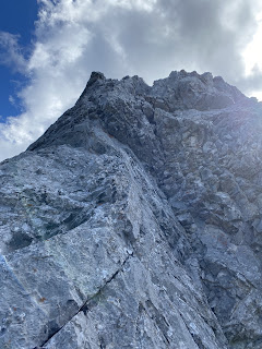
View of upper 5.7R pitch. 
Looking up last pitch, P7.

Exposed scramble to final summit.

OSWB just below the steep scramble, just above the top of pitch 7.
Photo by Laurie

Nice new summit register.

Laurie on the summit.
I am headed to the first rap station.

Great day, super cool little feature.

Monday, April 18, 2022

Mt. Engadine - South Ridge, solo ski/scramble attempt

Mt. Engadine from the road.
South Ridge is the long ridge on the right side.

Another view to the South Ridge. 
Mt. Engadine summit is the pointy highpoint on left. 

Got out for a wonderful solo ski day on Sunday April 10. The weather had cooled off quite a bit, with some good snow pack stability, so I figured a solo ski up a good sized mountain was in order. Poking around maps and books a bit, I thought the South Ridge of Mt. Engadine would be reasonable route for winter conditions, cold temperatures, and a forecast with cloud cover in the afternoon. 


Approach trail well packed.

Started slog to South Ridge via old avi debris.

Views open up towards Mt. Birdwood and Mt. Smuts.

Used the well packed "Rummel Ridge" trail to gain access to the creek south of Mt. Engadine. Once at the end of the creek, headed up old avalanche debris, but moved to south slope in the trees. This slope was super hard, sun affected, but solid crust. Used crampons to make the long South Ridge. Once on the South Ridge proper, the ridge was fairly exposed with many steep rock steps and many scary cornices. Lots of fun snow climbing with stable conditions. 

Nearing the South Ridge, fun rock scramble. 

The ridge becomes snowy.

View to the "Tower".

View to "Rummel Ridge". Right and centre of photo.

Here comes the snow.

Lots of interesting and fun cornices.


I can finally see the summit.

Summit in the distance.

Lots of great snow features.


Nearing the summit, maybe 200 horizontal and 150 vertical metres away, there was a sharp and dramatic drop in the South Ridge. The right side (east side) was a near vertical drop, super loose rock, and no sane way to descent. The left side (west side) wasn't much better, but had the extra feature of peddles on steep slab. I looked at a few options but decided to bail. Really enjoyed the day and didn't want to risk something serious. Turned back. Did find a ridge sections where I stayed above the cornice line, easier travel then my up hill line. Great day out. 
 
Turnaround point. 


View to summit.


Wednesday, February 16, 2022

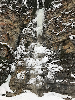
Good H’evans Thomas - WI3, 40m

Good H’evans Thomas - WI 3, 40m
FA: Pat Paul, Vaclav Vaclavik (both solo). March 1982
.

Evan-Thomas Creek (ETC). Laurie and I went climbing in ETC February 8. I was really surprised at the amount of hikers and dog walkers in the upper canyon. Different times. The bolted chain hand rails make the upper canyon much more accessible. The long causal day reminded of previous adventures in ETC.

I first entered the upper Evan-Thomas Creek canyon in March of 1995. Tony Barton, from Fort Williams, Scotland, and I had a late start to the day, Moonlight wall area was packed, so we headed upstream to find Good H'evan Thomas. Turns out we did a first ascent on "B2", but I didn't realize that until 2008. B2 is situated 0.5 km upstream from Combo Falls.

Steve Blackwell and I came back to the upper canyon in January of 2005, using the game bypass trail at the start of the narrow canyon, trail just pass Combo Falls. WD40 has huge, I have never seen it that big since. Steve and I top roped the pillar that day. 

January 5, 2008 Jason Wilcox and I did the first recorded ascent of WD40 (lead from bottom to top). That day in January, Jason and I climbed Green Monster, WD40, Slurpee and Good H'evans Thomas.  

B2 - WI3, 30m 
FA: Kevin Barton, Tony Barton. March 1995

WD40 February 8, 2022

WD40 January 2005
Steve Blackwell at the base of WD40 in January of 2005
First time I saw this route, it is huge, have never seen it that big since
.


Slurpee - WI4, 35m
FA: Kevin Barton, Jason Wilcox. January 5, 2008.


 Green Monster - WI4+, 30m
FA: Kevin Barton, Jason Wilcox. January 5, 2008.

Slurpee was way to wet and poor ice to climb.
February 8, 2022.

Laurie and I were hoping to climb Moonlight, but a team was just a head of us, Snowline and Too Low for Zero were too thin for me. We headed up to the upper canyon, along with thongs of hikers. We couldn’t climb WD40, no ice on the bottom. Started on Slurpee, but the route was nasty, wet and super hard to protect, so I bailed. I got a bit wet, so we did a hike to dry out and hiked to Good H’evans Thomas for some easy laps, had fun climbing mini steps in the creek. Did a few fun and causal leads up Good H’evans Thomas. Finished the day with us soloing up and down the little Exit Combo pillar. Fun day out in ETC.

Fun step in creek enroute to Good H'evans Thomas

Good H'evans Thomas

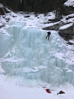
Rapping off Good H'evans Thomas

Friday, February 11, 2022

Ptarmigan Peak - Ski South-West Slopes

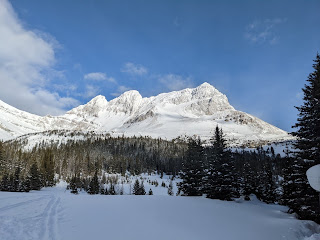
Ptarmigan Peak from Halfway Hut

Great day of turns with young guns John and Colin. Plan A was to summit Ptarmigan Peak, but the summit ridge was being raked with high winds, so we did laps on the south west slopes of Ptarmigan, just above Hidden Lake. Great snow at tree line and just below. Blue skies and lots turns. 

View to Ptarmigan from near the hut.

Quick snack in the historic Halfway Hut.

John breaking trail.
Photo by Colin.

Uphilling towards Ptarmigan.
Photo by Colin.

OSWB.
Photo by Colin.

Once in the alpine, great views.
Photo by John.

View to Ptarmigan Peak.
You can see the huge snow rooster off the summit ridge above Colin's head.

John switching to downhill mode.

Colin getting ready to rip.

Majestic Redoubt Mountain.

Ptarmigan Peak. 
Our turns were 2500m and then back to tree line.