 |
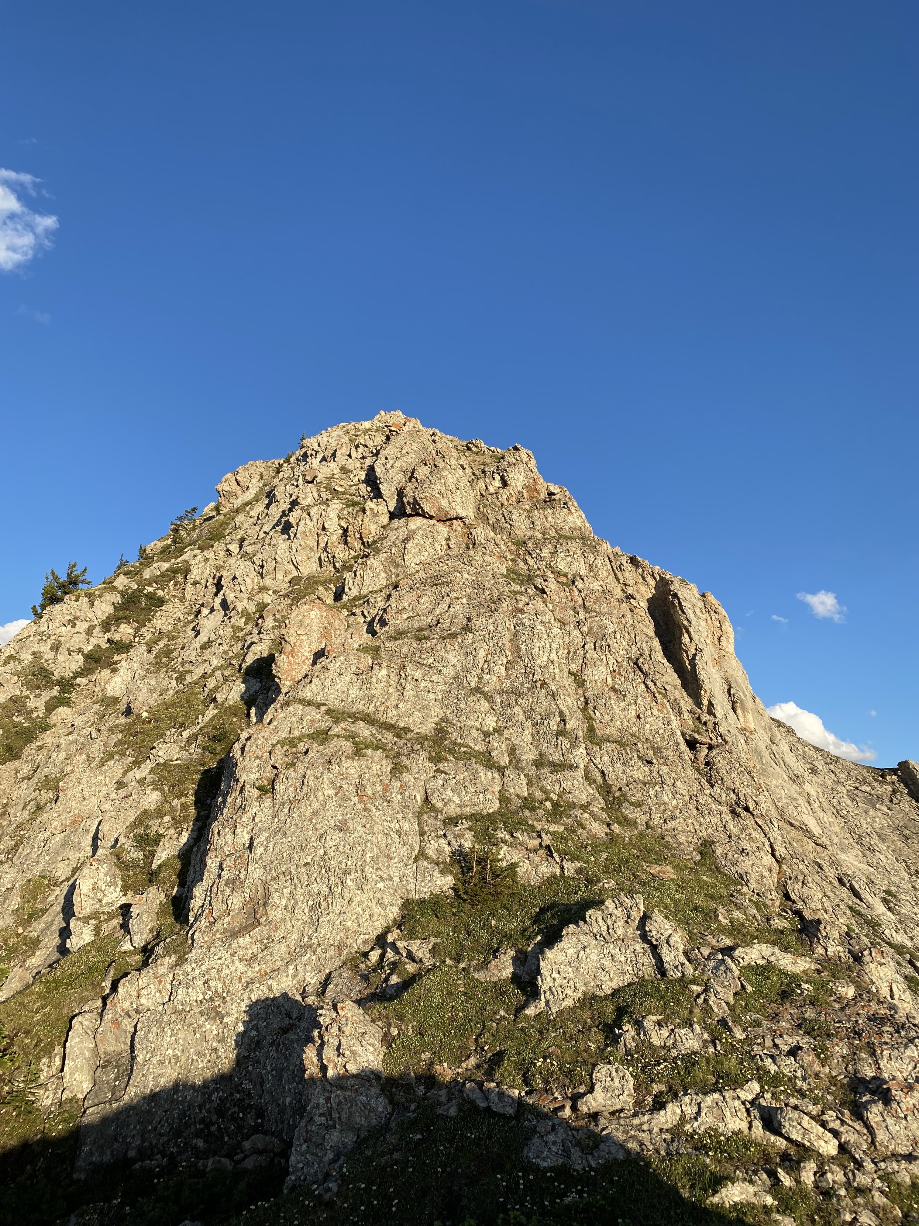
View from Opal Creek to the "Cat's Eats".
South summit is the right summit. |
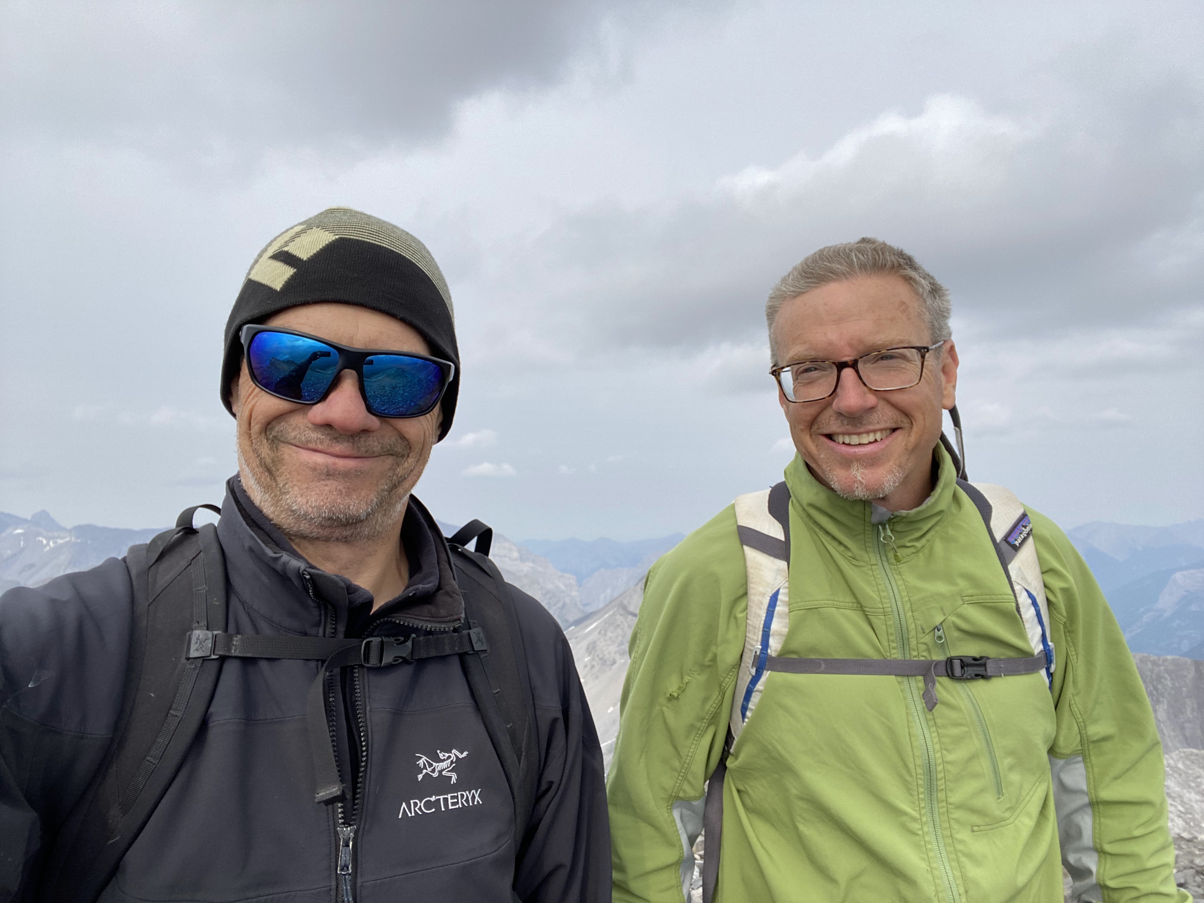
July 22 Scott Berry and I were successful on our climb of “Cat’s Ears” (GR383179). We had attempted this peak in July 2023, but didn’t figure out the route description. We climbed the West Face of South Cat’s Ear on the Don Forest/Gene Fraser route (1981), or close to it. The upper mountain, once at the col between the two Cat’s Ear, is a series of steep loose gullies, with steps of varying rock quality up to 5.6/5.7. A truly scary choss fest. The final pitch to the summit was fun 5.6 on solid rock with great pro. Not all the 5.6 climbing was as high quality. Incredible views from the summit ridge. Two high points on the summit ridge. Both appeared to have cairns, but I carefully disassembled both and found no register. I left a new summit register and book. Based on my research, our ascent is the second ascent. A stunning summit, but hard climbing on loose terrain, not an easy day for sure. Super happy to reach this elusive summit.
 |
"Cat's Ears" from Piper Creek.
View to South-East aspect of Cat's Ears.
I have always assume the name originated from this view of the peak. |
When I first developed the goal of my Opal 35 project back in 2011, there was very limited information for many of the peaks in the range. The old Green Book, "The Rocky Mountains of Canada - South" (Glen Boles, Robert Kruszyna and William Putnam) does not have any information on the Cat’s Ears, but first ascent accounts were published in the Canadian Alpine Journal (CAJ). David Jones' guidebook (2020) "Rockies South. The Climber's Guide to the Rocky Mountains of Canada: Volume 1" was years away from being published, and I provided much of the information for the Opal Range section to David. The CAJ write up's are the same descriptions as in the David Jones guidebook and use the Cat's Ears titles.
 |
Route description from
David Jones guidebook (2020)
"Rockies South. The Climber's Guide to the Rocky Mountains of Canada: Volume 1" |
 |
| CAJ article on Cat's Ears. |
Worth noting, the red line indicating the route on page 91 of
the David Jones' guidebook is incorrect. The red line location heads up a near
vertical drainage gully system, where the text description is correct;
hike/scramble to the col, but there are two short slab 5.6 sections below the
col. When we climbed the South Cat’s Ears in 2024, we scrambled up and down
these two slab sections, but when we climbed the North Cat’s Ears in 2025, we
belayed and pitched the climb up, and then rappelled, these slabs.
 |
| page 91 of the David Jones' guidebook |
 |
Approximate location of routes on South (r) and North (l)
Cat's Ears. View from Opal Creek. |
From the trees and grass of Opal Creek, slog up low angle
scree slopes towards the drainage that is just left of the col between the two
Ears. Where scree turns into steepening slabs, trend left on easier terrain,
climber’s left of a bulging buttress. First moderate slab scrambling, then
difficult fourth to fifth class terrain on peddle covered slabs, as you near
the col, the angle lessens again. Just below the col, there are the two 5.6
slab sections, with easy terrain between these slabs.
Just below (about 30 metres below) the narrow tight gap
between the main summit blocks of South and North Cat’s Ears, turn to climber’s
right below the vertical cliffs of the summit block, traverse right, first over
a bump then below the slab wall of the summit. With the steep summit wall on
your left side, head up a ramp that steepens to low fifth class (5.5 ish) at
the top.
From the top of this ramp, traverse right into another ramp,
follow it to its end. Exit the second ramp just below the top on the left side
of the ramp, climb a short pitch of 5.5 for about 25 metres. Then a short pitch
of 5.6 to the summit ridge, only solid rock on the whole mountain is on this
final pitch. Easy hike on the summit ridge to the highpoint on the northern
end. We traversed the whole summit ridge and built a cairn and left a new
summit register (black ABS tubing) where the ridge seemed the highest.
Descend the same way, we did two rappels between the summit
ridge and the col.


.HEIC)


