Thursday, August 20, 2020

Mount Delphine - NW Glacier to NE Ridge, Alpine II


North West aspect of Mt. Delphine from near Peter Pass.

August 9, 2020 teamed up with my old climbing buddy for a second attempt at Mt. Delphine. Raff and I have some bad beta about the condition and length of the McDonald Creek Forest Service Road (FSR) back on July 22, 2012 when we attempted to day trip Delphine from McDonald Creek. The road ended way sooner than hoped and the valley looked very difficult to ascended, since we only had the day, we bailed to Jumbo Pass and had an enjoyable day scrambling Bastille Mountain. See trip report here.  

Raff had obtained some beta from long time and well experienced local climber David Salahub. David and this team ascended Mt. Delphine from the end of the McDonald Creek FSR back in the Fall of 1988. His information was the same as our old beta from 2012, but now we knew a single day push was not possible and brought bivy gear.

From Calgary we had an early start, drove to Radium and then to the McDonald Creek FSR and the road ended even earlier than our 2012 trip, at a creek crossing where the bridge was removed. Back in 2012, we were able to drive across this bridge, but only made it an additional 400 metres to a huge avalanche wash out across the road. We parked at the old bridge site and loaded up for the hike.

Map doesn't show parking location. Map indicates
bivy site, approach to Delphine and our ascent/descend route
.


The day was gorgeous and super warm. The wading the of creek was straight forward and refreshing. Then a simple walk up the old road for a few kilometres. Where the road ends there was some light bushwacking to reach the bottom of the head wall way below Peter Pass. 

At the end of the McDonald FSR, view to Mt. Delphine.

Bridge removed and the end of the drive on the McDonald FSR.
View to Mt. Farnham (l) and Farnham Tower (r).
Main summit of Mt. Farnham is the highest in the Purcell Range.
Farnham Tower is over 11,000 ft. (3353m).


Pleasant crossing of McDonald Creek.

Nice easy hike up the road for a few km's.

Old road ends at a cut block, view to the headwall.
We ascended ledges just left of the water fall.

The road ends is a few km's, find we picked our way through an old cut block to the base of the head wall, basically no bushwacking. We started picking our up, easy at first, we did spy a few cairns about halfway up, the exit at the top required a few hands on difficult steps to ascend up, kept things interesting.

Nearing the top of the headwall.
Mt. Peter visible on the horizon.

Nearing top of head wall.

View from the top of the head wall down the McDonald drainage.

Once above the headwall, easy scree hike towards Mt. Peter.


Once above steep head wall, simply head west towards Mt. Peter, easy travel on nice scree and a few small snow patches. 

From near our bivy spot, view up to Peter Pass.
Old glacier has melted a lot since David was here in 1988. 

Just above our bivy site, view to the glacier edge we ascended to.
While I made dinner, Raff found us a mellow line up snow and rock to the edge of the glacier.
Basically the snow patches in the middle, lower down, then up the nice snow line up.


View to Mt. Peter.
Summit is the left high point. 
I bet the snow couloir climbs well to the low point right of the summit.

Sky got cloudy as we had supper.

Once we arrived at our beautiful location, we wandered around a bit to soak up the beautiful alpine tarns and the great views. The glacier to access Peter Pass was small and very steep, a full alpine climbing adventure. Raff volunteered to scope out a route and headed up the slope more east of Peter Pass to find us an efficient line; I started dinner. Raff found a great line, so we had dinner and headed to bed. Overnight it got very windy and the day started very cloudy with all the high summits in cloud. We had some coffee and breakfast and headed up. 

Climbing day. The morning was cold and cloudy. 
Raff on the edge of the glacier on the way to Peter Pass.


After traversing below the glacier for a short way, 
we headed onto a short section of glacier to reach Peter Pass.

 View to Mt. Peter over Peter Pass. 

Overall, fairly straight forward to reach Peter Pass. From camp we started on snow patches, a bit of scrambling, back to some steep snow, reached the edge glacier, which was very broken here, then traversed below the glacier on an exposed rock ledge. Eventually we reached a flat section of the glacier, traversed easily over to the rock of Peter Pass. From the pass you head south and drop about 300 metres to reach the edge of the glacier on the North West side of Mount Delphine. All easy, but not fun, just scree slogging. Funny thing happened as Raff and I were slogging up the edge of the glacier, ascending into the clouds, we saw a solo climber descending. Turns out Raff knew the climber, of course he did. Matt is from Invermere and a seriously fit climber. Matt backed off on the summit ridge because of icy conditions and basically no visibility. Well, since he knew Raff and liked the concept of a rope and extra the security of additional climbers, he decided to join us for the summit. Us three continued our slog up scree beside the steep glacier.  Nearing the start of the summit ridge, visibility was basically zero. Soon after gaining the ridge, the ice of the face glacier meets the ridge, along with many large cornices. 


Our first view of our route on Mt. Delphine from Peter Pass.

You must drop a few hundred metres to approach Delphine from the pass.
The route ascends scree left of the glacier to also the summit ridge. 
About half way up this slope, we ran into a solo climber descending.


Nearing the upper North East ridge of Mt. Delphine.
The glacier can be seen on the summit ridge.
(Photo taken on descent)

Nearing the upper North East ridge on the ascent.

On the upper North East ridge, the first section was easy climbing with a mix of rock steps and snow patches. About one third of the way up the ridge, the ridge becomes covered with glacier ice, and a very exposed view with a steep drop down the North West face. Just before the ice, we roped and continued with a running belay of ice screws. Matt skillfully lead us to the summit of Mt. Delphine after a traverse of icy slopes and some interesting cornices. Once on the summit, the skies cleared more and more and we were treated with excellent views of the surrounding Purcell mountains. 

Typical terrain on the first section of the summit ridge. 

Low visibility as we started on the icy summit traverse.
Skies cleared more and more.
Typically could keep feet on snow, but lots of icy sections.

Rock point contains the summit register, almost there.

OSWB on the summit of Mt. Delphine. 
Photo by Raff.

Raff strikes a pose on the summit of Mt. Delphine. 

Nice copper summit register. 

Last record in the summit register was a solo ascent by the late Trevor Sexsmith.
On Trevor's old web site (still active in 2020) there are a lot of great videos and trip reports of his bold ski descents
(and climbs).

Matt looking chipper on the summit. 

View from the summit back along the icy upper North East ridge.

Heading down.

After enjoying the improving summit views for awhile, we headed down in clearing conditions. We traveled quickly to the bottom of the North West glacier. We took a long lunch break and had a few laughs and interesting conversation before heading our separate ways. Matt had approached via Farnham Creek, so he headed back to his bivy site, eventually back to his vehicle to head home to Invermere that day. Raff and I had planned to spent a second night at our bivy. Raff and I plodded back up hill to Peter Pass, then back to our bivy site. Dinner and early to bed. Up with the sun on the third day and started our return to Raff's vehicle low down in the McDonald Creek drainage. Overall, a great trip, and great to climb with an old friend. Good times in 2020.

View from our bivy back to the mighty Mt. Farham.

Downclimbing one of the difficult steps on the descent of the headwall.

The glorious Mt. Farnham and Farnham Tower.
Tower is the big bump on the far right ridge line, a separate official summit and over 11,000 ft. 

Just below the head wall, beautiful flowers in McDonald Creek.

End of a great trip.

Saturday, August 8, 2020

More Cowbell - 5.7, 325m (10 pitches)

View up pitch 2
Looking up pitch 1.

Laurie heading up pitch 1.
Laurie leading pitch 1.

Had a blast, wind blast, on More Cowbell with an afternoon/evening climb (Aug. 6), with my good buddy Laurie. Originally we had planned to climb this in April, but my all alpine plans have been messed up this season. Rain threatened at the start, but gale force winds blew it away. Great rock on this route. The first four pitches have super textured and water runnelled rock, very cool. All the pitches had good rock quality and lots of fun for the grade. The high winds made rapping the route extra fun.

High quality beta available here . 


Is that raining coming this way?

Between pitch 4 and 5 you hike about 30 metres up easy terrain to the base of pitch 5.
Left of the route is a cool big slab and a steep corner, pictured here.
The top of the steep corner provides scary exposure for the crux moves on the second last pitch, and for setting the second rappel off the top of the route. 

Laurie heading up pitch 5


Laurie at belay above pitch 5.

Laurie lead the crux pitch, pitch 9. 
The crux moves are slab moves with little hands and only fiction feet.
The pinch point of the long roof is the exit off the slab.
Solid 5.7 or more! 


OSWB at the top of the route, top of pitch 10.
Very cold wind blowing.

Laurie ringing the cow bell.

Looking down from the anchor on top of pitch 9, to the crux.
The straight down fall line of the rope puts the rope into the steep corner seen from
below pitch 5. This rappel is difficult to control, especially in high winds.
Care is needed. 


Friday, August 7, 2020

GR401125 "Elpoca South" - South Ridge, Scramble

Summit of "Elpoca Mountain South" and view northward along summit ridge
towards the main summit of Elpoca Mountain.


An interesting day out on August 5 on the most southern high point on the long summit ridge of Elpoca Mountain. Initially I was confused about the location of the summit compared to the route description, but after hiking around the base of the peak and viewing it from a nearby summit (Elpoca Tower), I am convinced the route description is not correct. 


North side of Elpoca Mountain viewed from near Piper Pass.
Elpoca Tower is seen in the lower left.
Photo taken September 18, 2016

Elpoca Mountain is a huge and complex mountain, with a long summit ridge over 3 km long with many steep faces and buttress extending off the massive summit ridge. I had the pleasure of ascending this glorious peak by putting up a new route on the north face and north ridge back in 2017, trip report here. Between the main summit and the southern high point, there is a complex and broken ridge line. 

David Jones is creating a full new set of guidebooks for climbers in the Canadian Rockies. I have provided David with a lot of information for my small list of new routes and a couple summit first ascents. David's guides are impressive and provide route information for almost every mountain in the Rockies, quite the achievement. Having one day for a solo trip on August 5 (was heading to the rock route "More Cowbell" on the 6th) I had a few ideas, couple of which I decided against because of bear warning on the approach. I chose "Elpoca South" since I had walked by, and viewed this high point, many times over the years. 

The route description in the recent guide, Rockies South, states; 

67 South Ridge         PD+ low-5th 50m
John Martin (solo).  July 27, 1999

From the Elbow Pass Trail, ascend the easy south ridge, with detours on the right as necessary, to a lower summit (mostly 2nd-class, with short sections of 3rd-class and slabs). Then downclimb into a notch (steep and exposed, with minimal protection) and continue easily to the higher peak. Ascent: 3 hours. 

The photo that shows the route is shown below. Well short story, I reached the high point labeled as "Elpoca South" in the photo. It was easy to get there. There is steep and loose 5th class downclimb required into a notch to continue north, but it would eventually lead to the high point on the photo identified as " 63 ". To reach "Elpoca South" the downclimb is not required. I did most of the downclimb, but above a steep, overhanging section, just above the low point, but it was 5.6 ish and very loose, I retreated since no one knew where I was and I was solo. 

Photo from
"Rockies South. The Climber's Guide to the Rocky Mountains of Canada: Volume 1"
Author David P. Jones


On August 21 I attempted Elpoca Tower, but the weather turned on us. September 11 I was successful with an ascent of Elpoca Tower. On these two trips, one must basically circumnavigate "Elpoca South" and high up on Elpoca Tower, one gets a great view of the southern end of the long Elpoca Mountain massif. I am convinced I reached the high point on the south ridge and the sub peak of "Elpoca South". 


View to "South Elpoca" from the approach to Elpoca Tower, the high point on the left
is the summit I reached.  The summit cairn is visible.
Photo taken August 21, 2020. 


View to "South Elpoca" from the summit of Elpoca Tower.
Photo taken September 11, 2020. 

View to "South Elpoca" from the approach to Elpoca Tower.
Photo taken August 21, 2020.

Now trip details from August 5; I had a later start than desired since I was debating objectives in the morning and arrived at the Elbow Lake parking lot about 10am. It was already crazy packed and parking difficult; welcome to the Rockies of the 2010/20's; not like the old days. Wasn't sure where to gain the south ridge from the parking lot, was feeling lazy about a bushwack, and since the hike is so short to Elbow Lake, I decided just to hike to the lake and scope out the approach. Blasted past all the tourons and continued past the lake to get the best view of the south end of the Elpoca massif. Had a pleasant chat with two gentleman in their mid 80's out for a hike. They were moving well for such well experienced man. 

About half way to Elbow Lake the south ridge of "Elpoca South" is visible. 

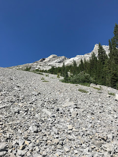
Long scree slog awaits.
Gained the big scree slope right at the lake shore and headed straight up.

Once at the north end of Elbow Lake, I tried to spot a good line up. I choose a line that was more like the South East Face, below the South Ridge. The scale is small since the horizontal and vertical distances are small, so the names sort of seem too big. Regardless, there is a old avalanche path of scree and boulders that comes right down to Elbow Lake on the west shore. I just started plodding up this slope, as I got a bit higher, the face does get steeper, I chose a line beside a bump of solid rock since it was less loose, above the bump, the face was steep slab with pebbles, but was travel was reason. After maybe 450 metres of gain, I reached the South Ridge proper. 

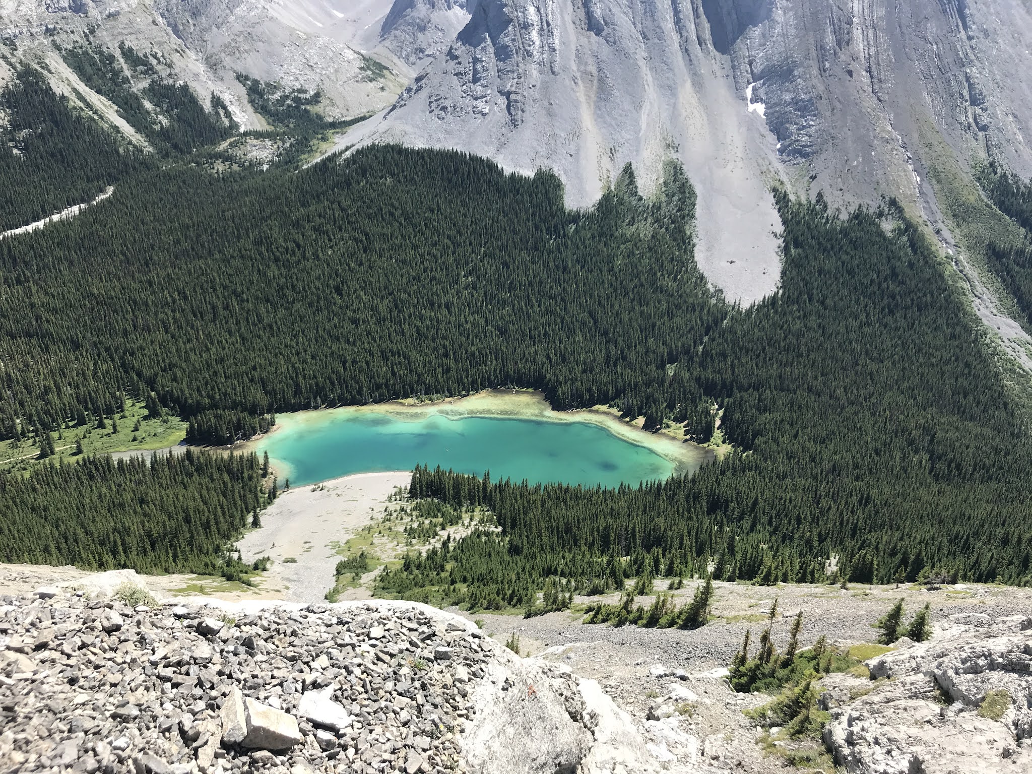
View to Elbow Lake near start of rock bump.

SE Face above the rock bump, view to the South Ridge.

On the South Ridge, view down slope to the rock bump
and Elbow Lake below


View up South Ridge, mostly moderate scramble with some exposure.

Final ridge below summit

Summit cairn on "Elpoca South"

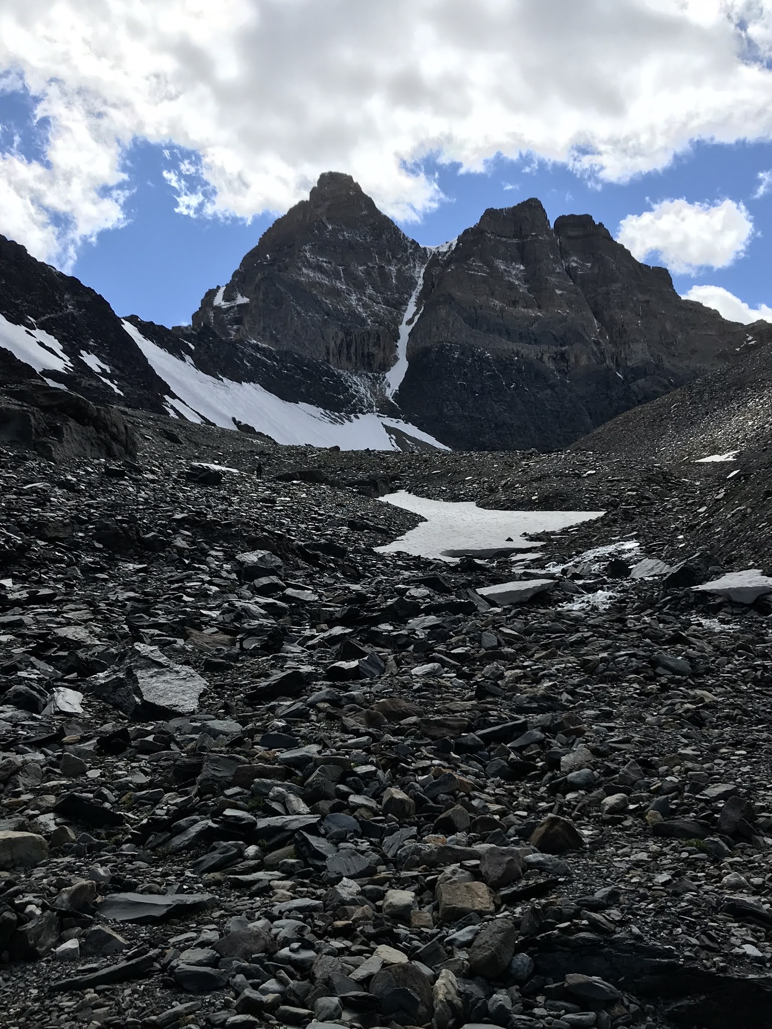
Once on the South Ridge, it was mostly an enjoyable and moderate hands on scrambling to the first high point. There is a couple of exposed sections down the West Face to highway 40, but overall, very straight forward. Once on top, the views, especially towards the main summit of Elpoca Mountain, Elpoca Tower and Tombstone Mountain, were fantastic. 

Awesome view from "Elpoca South".
Left side, long, serrated summit ridge reaching to the main summit of Elpoca Mountain.
Right, view the two Tombstone peaks, Tombstone Mountain, north, highest summit, above 
Elpoca Tower, and "Tombstone South" most right.

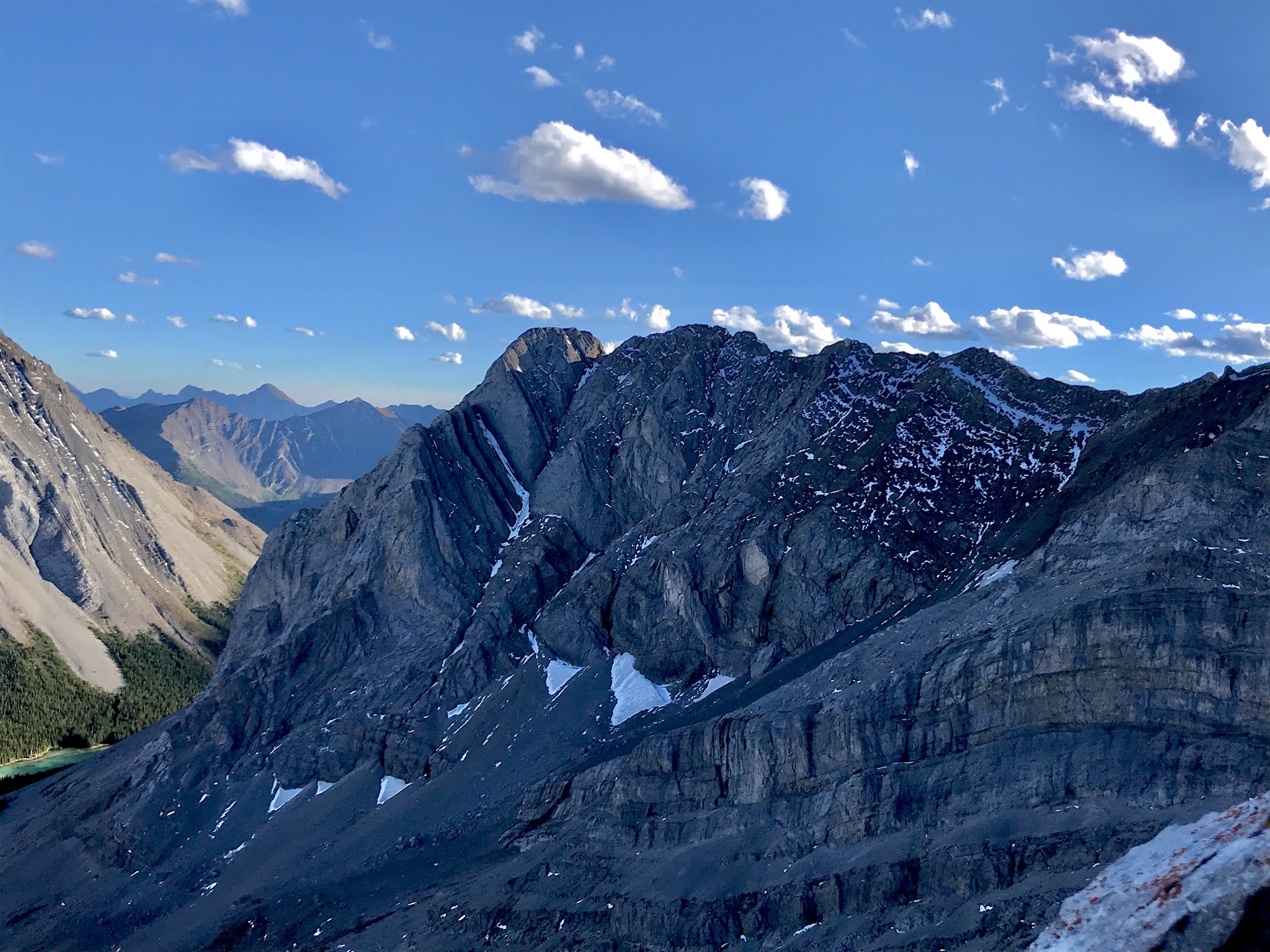
Closer look at Elpoca Tower and Tombstone Mountain behind.

Elpoca Tower in the foreground (success on my third attempt, Sept. 11, 2020)
Tombstone Mountain main summit behind. 
The obvious rib, beyond and behind the tower, I climbed on Tombstone Mtn way back in 2003.

Once at this high point, I was expecting to see an obvious gap, downclimb, with a higher summit to the north... well, there is a 5 th class downclimb to continue north, but that other high point is very far away, and not sure it is higher. Confused, I tried the downclimb, the upper part was very loose and maybe 5.3, about 30 metres down, there was a larger rock bay above the last steep section. The view down looked difficult, looked like 5.6 or more, and likely overhanging downclimb to reach the lower point of the ridge. Since it looked so difficult, I was solo and no one knew where I was, I backed off. Returning to the cairn and the high point, I looked around and decided I was on the summit of "Elpoca South" and I should just return to the car. So I did. Quick and easy retreat, beautiful summer day out,

View down the downclimb section

Not clear in the photo, but the last downclimb looked very difficult

View across the gap to the other highpoint, I am sure this other high point (63)
not "Elpoca South" 


Great view to Mt. Rae 

From highway 40, zoomed view to "Elpoca South"
The downclimb gap is clear.

South Ridge line from highway 40