 |
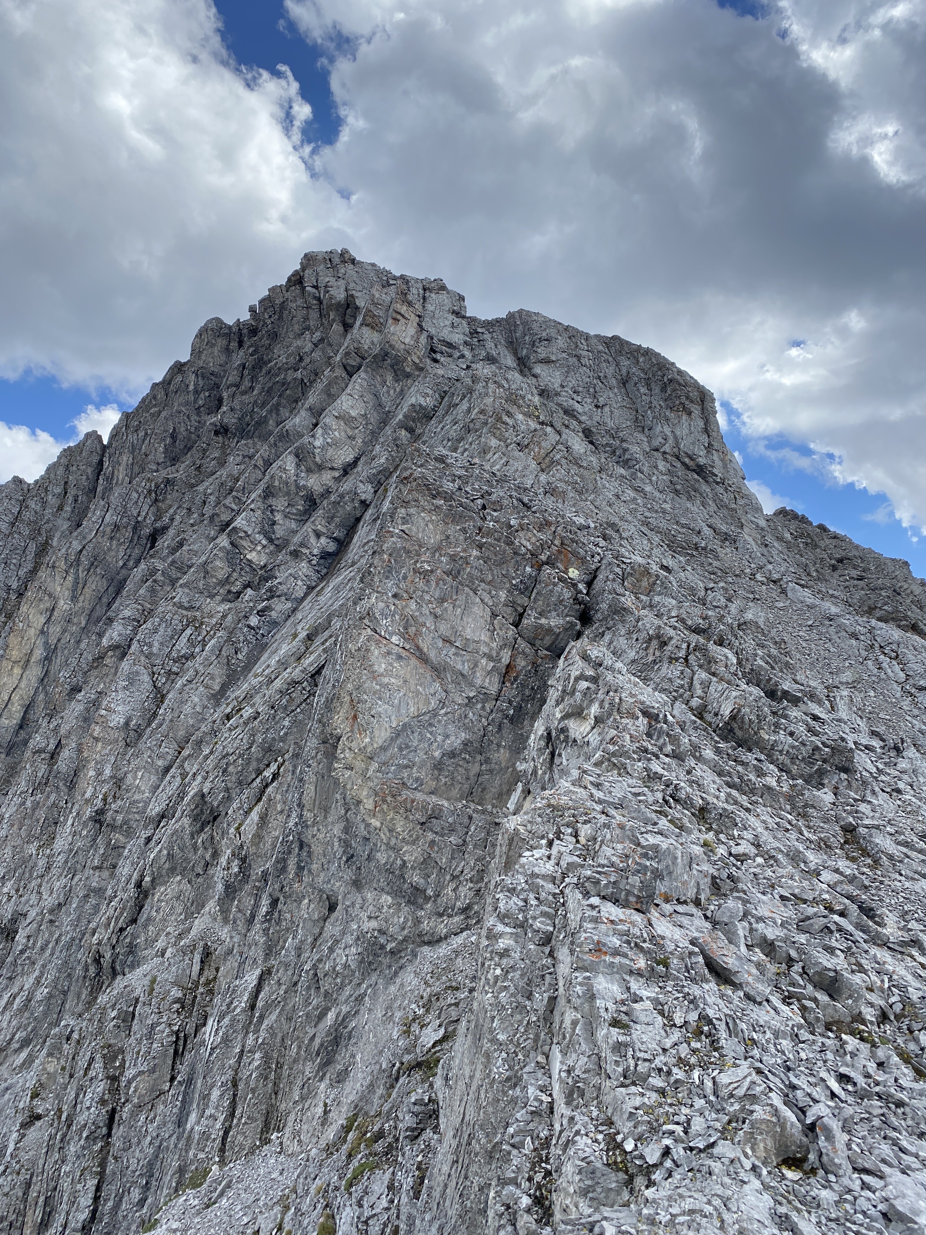
Cat's Ears
North summit (l), South summit (r)
View from the west. |
I was super excited and
stoked for this week. The initial plan was to summit most of my remaining Opal
Range peaks on my Opal 35 Project. Specifically, we were hoping to reach the top
of Cat’s Ears, both south and north summits, Mt. Barham, and The Blade. Also,
for fun, a traverse of Mt. Blane from The Blade, I have climbed Blane twice before.
5 summits with 7 full days, should be no problem right? Trip started with setting
up a basecamp at the Elkwood Campground in Peter Lougheed Provincial Park. We
pitched our tent and cooled our beer on Sunday July 23. The recent David Jones
guidebook (2020) "Rockies South. The Climber's Guide to the Rocky
Mountains of Canada: Volume 1" was the primary source of route descriptions
for this adventure.
GR 385179 ('Cat's Ears -
south') and GR 382180 ('Cat's Ears - north') attempt – July 24
Basically we went right too early. The description in the 2020 Rockies South book is about 550 metres of rock climbing with about one sentence of route vagueness. We basically reached the col between Cat's Ears South and Mt. Schlee. After pouring over photos, I know where to go next time.
 |
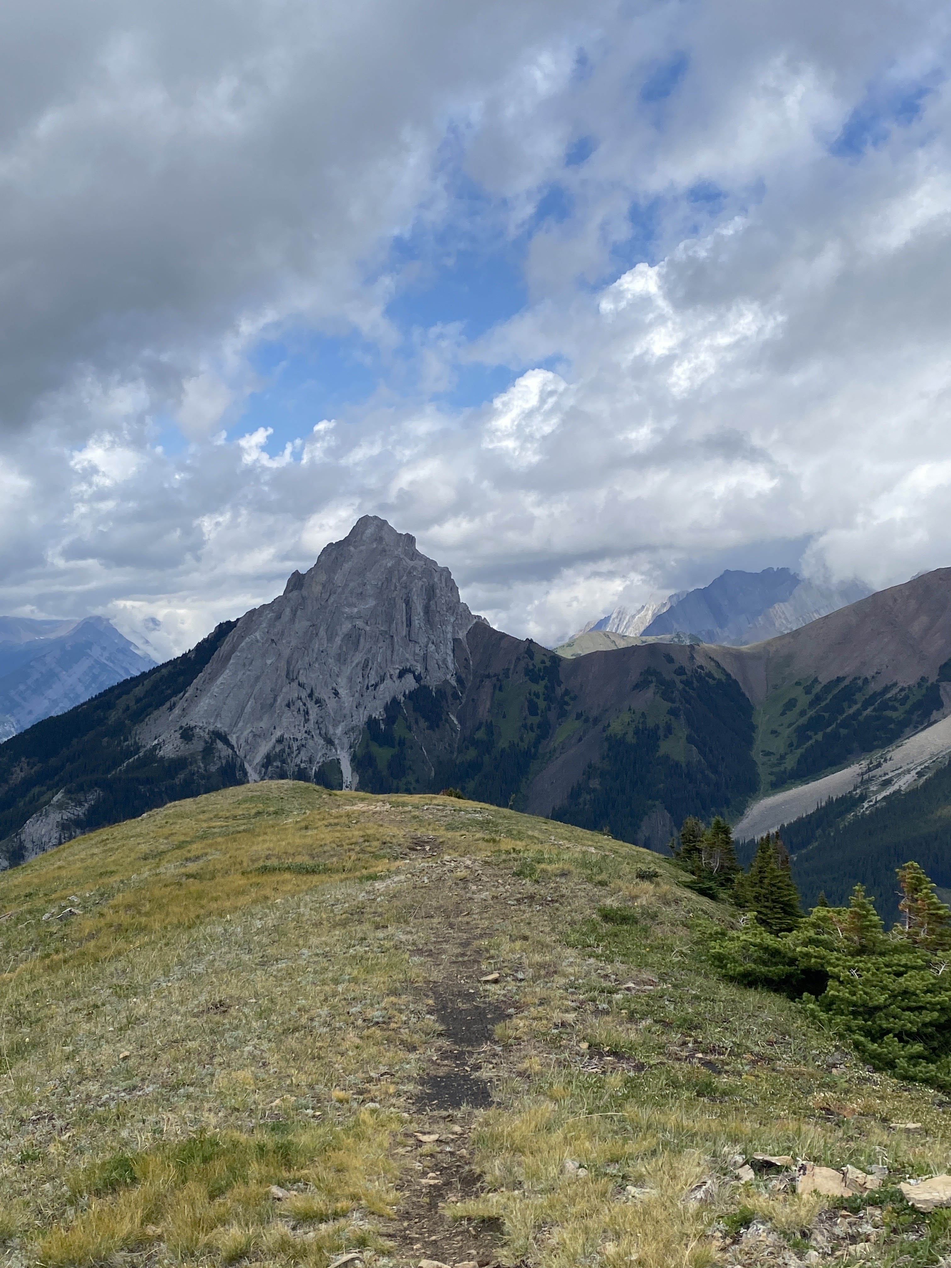
Turning tails, retreating from our highpoint on South Cat's Ear.
'Mt. Schlee' left of Scott's shoulder, Elpoca Mtn. pointy summit to the left. |
Rest day – July 25
Slept in, checked weather conditions, drank some beer.
GR 363205 ('Mt. Barham') attempt
– July 26
 |
| Looking up to "Mt. Barham" on the long approach slope. |
A very long and complicated approach, and we didn't even get to the col between The Blade and Mt. Barham. To where we got out the rope, from the parking lot at King Creek, took us about 6 hours.
I am fairly sure the red line indicating the location of the climbing route shown in the photo in David Jones guidebook (2020) "Rockies South..." is incorrect. Either the line is drawn in the wrong spot, or the YDS grade provided is incorrect.
 |
Photo from David Jones guidebook (2020)
"Rockies South. The Climber's Guide to the Rocky Mountains of Canada: Volume 1" |
 |
| Approaching the big slab. |
 |
Photo from David Jones guidebook (2020)
"Rockies South. The Climber's Guide to the Rocky Mountains of Canada: Volume 1" |
 |
The red line shows where I ascended.
|
 |
| Approaching the base of the route. |
 |
Photo from David Jones guidebook (2020)
"Rockies South. The Climber's Guide to the Rocky Mountains of Canada: Volume 1"
|
The David Jones guidebook (2020) "Rockies South..." indicates a grade of 5.7. It is not 5.7 climbing where the red line is drawn in the photo. When we reached the base of the big slab, we do go way right.
I was able to scramble up a gully to the access the slab higher up. From this
point, I followed a line up towards an overhang. All in about 25 metres of climbing
above the gully. At first likely 5.8,
then steepening to 5.9. I was able to get passive gear low down, but only
pitons where the climb got steep. I did have two bomber pitons in places as I
approached the overhang, but man, the overhang had no chance of protection and was
a strenuous 5.10 to make progress. Since I couldn’t see chance of protection above,
I chickened out. Not 5.7 climbing and I was exactly where red line was on the
photo. I have a theory of why the red line is drawn where it is, but I won’t
get into that here.
Eventually, I was lowered off my top piton. I tried a line
way right of the first attempt, and I did a pitch of about 50 metres of 5.6, but
above was nothing but overhanging huge roofs, so I rapped down. By this time it
was late in the day, and we headed down hill, tails between our legs. Got dark
before we reached the valley. Long day, but gained some great beta for next
time.
 |
View up the pitch I climbed.
Bailed at an overhang, lower section was 5.8 ish, then
steepening to 5.9+ and the overhang was likely 5.10+ to surmount. |
 |
Side view to the slab from further up.
|
 |
Red line is section that I climbed. Bailed at the overhang.
Does this look like 5.7? |
 |
Last view up the big beautiful slab.
Very cool slab feature. |
 |
Moon and sunset colours.
View to the summit of Mt. Wintour. |
Rest day, South (Little) Lawson Peak – July 27
Very chillaxing day. Threatened to rain all day, cool and cloudy, not a day to bivy high or traverse serious terrain. Hike up Little Lawson and went to Kananaskis Village for dinner. Great views back to our intended objectives in the Opals.
 |
Elpoca Mountain.
Scott and I climbed a new route on the north side of Elpoca
back in June 2017. |
 |
| Opal beauties. |
 |
Mt. Blane on the left, 'Mt. Barham' on right.
Our original plan had us bivying at the col between these this night. |
 |
'Rocky Peak' on the left, sharp pointy summit.
FRA to Laurie Kimber and I on that summit in 2014.
'Mt. Denny' double summit on the right. |
 |
| Scott on the summit of little, Little Lawson. |
“Unnamed 2866m” – Scramble – July 29
Separate and detailed trip report provided on my blog. See here.
 |
Elbow Lake in the foreground.
2866m in the centre. |


