 |
| Three summits east of Elbow Lake. |
After determining the
weather forecast didn’t allow a long enough window for another attempt at the
long and complicated Opal Range summits we were hoping for, we turned out
attention to a group of summits near Elbow Lake. The recent David Jones
guidebook (2020) "Rockies South. The Climber's Guide to the Rocky Mountains of
Canada: Volume 1" provides a route description for the three
summits immediately east of Elbow Lake. This guide provides routes for these three
peaks, identified by the elevation of the summits; 2835, 2866 and 2847. Our plan for Saturday July 29 was to reach
all three summits. First up, tackle route 3 on peak 2847, then back track to
Elbow Lake, then up route 2 on peak 2866, then hopefully directly link on the
ridge line to summit 2835, and probably return to the valley by route 1.
 |
Overall route photo for 2835, 2866 and 2847.
From the David Jones guidebook. |
 |
| Page from the David Jones guidebook for these three peaks. |
 |
Map of the Elbow Lake area, including the 3 summits.
Red line, David Jones descriptions, green lines, our approach.
Blue lines, our scramble on 2866 and 2847. |
 |
| Blue lines approximate route on 2866 and 2847. |
Standard plod up to Elbow
Lake, early start so the trail was quiet and the sky was clear, enjoyed the beauty
of the day and impressive scenery.
 |
| The always impressive Elpoca Tower. |
 |
Elpoca Mountain behind the tower.
Main summit is right most point along summit ridge. |
 |
Cat's Ears (south summit) above Piper Pass
(right of the tower).
Mount Jerram visible left of Cat's Ears. |
Hiked to tight cirque north of the summit of Mt. Rae, south and south west of the summit of 2847, tried to find the described route, no luck. We tried to ascend several sections that would lead to easier ground, but couldn’t find an easy line. We did 3 serious attempts to climb the south or south west aspect of 2847, but our lines ended in sections of loose and dangerous 5th class climbing, and we didn’t bring a rope. After a few hours of attempting different lines on this peak, we bailed back to Elbow Lake.
 |
| Typical terrain, we couldn't find an easy line. |
 |
| We tried to scramble up this, but it was too loose and steep. |
Once back at Elbow Lake, we
hiked about a kilometre north from the lake, on the big old Elbow River trail, until
directly below the West Ridge of 2866. Picked a line through the trees to the big
open slopes west of 2866. We slogged up easy scree to the low point on the ridge immediately north of the summit block of 2866. Once on the ridge, we took the North West Ridge directly to the summit, will a few minor diversions on the right to avoid some steep blank sections, overall moderate to difficult scramble.
 |
| Hiking up west slopes. |
 |
| More slogging up to the North West Ridge low point. |
 |
| Great views. |
 |
| Scott happy to be at the ridge low point. |
 |
| View up North West Ridge. |
 |
| View down final section of ridge. |
 |
| Scott at the summit cairn. |
 |
| OSWB at the summit, got to leave a new summit register. |
Cool summit views. Big cairn on the top, but no register. I happened to have a couple of books, pencils and ABS tubing containers. Had the honour of leaving a new register. Looking to the south east, there was a nearby highpoint that could have been higher, so we hiked over there as well. Seemed to be the same height as the cairned peak we were first on. Headed back down the same way we came up, back to the low point on the North West Ridge.
 |
| Back at the low point, looking up to the summit of 2866. |
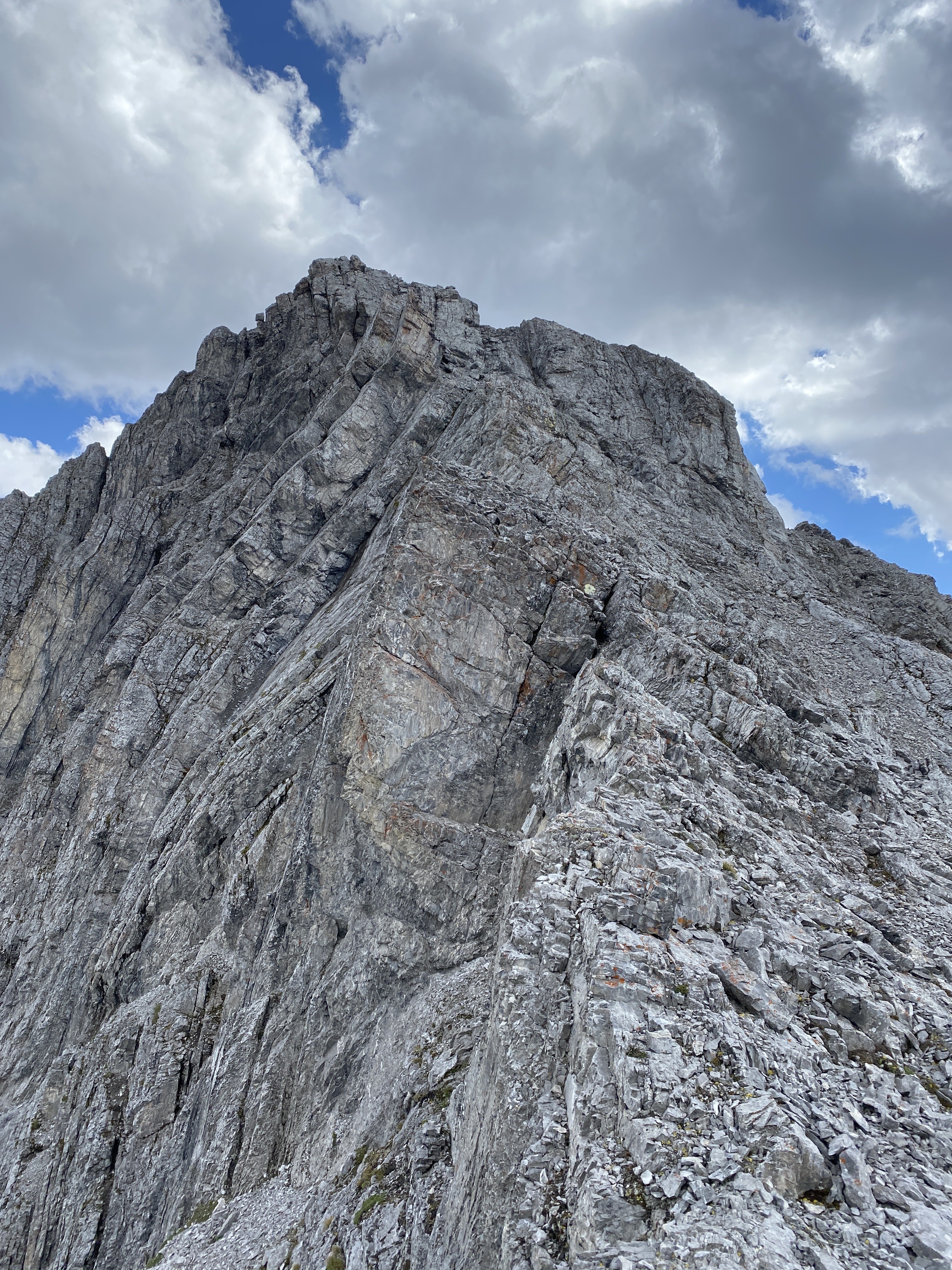
From the low point on the North West Ridge we headed north on the ridge direct. Easy travel for a bit, then some fun moderate scrambling over the first ridge bump, then easy travel to the final difficulties. I did a difficult scramble, on mostly excellent rock, to the summit of a pointy highpoint just south of 2835m. Scott was too tired to follow and we retreated back to the valley and hiked out with some beautiful views. Fantastic day with impeccable company.
 |
| Some easy hiking northward. |
 |
View as near the summit of 2835.
I made the top of the pointed highpoint left of the main summit. |
 |
View to the point I reached.
Cat's Ear (South) and Mt. Jerram behind. |
 |
| The closest I got to 2835. Summit not visible here. |
 |
| 2866 getting some cloud build up. |


No comments:
Post a Comment