Thursday, July 31, 2025

"Cat's Ears" (GR382180) - North Summit - Attempt / East Opoca (GR376159) traverse

July 27 was Scott’s last full day in Alberta and we figured with the marginal weather forecast we would make a Hail Mary attempt to climb “Cat’s Ears North” (GR 382180). We weren’t expecting success when we hiked up Opal Creek in fog and a light drizzle. We pressed on to the Col between South and North Cat’s Ears, but soon thunder and rain sent us retreating to the valley. We decided to traverse “Elpoca Creek Hill”, or as I like to call it, East Opoca (GR 376159), on the way out. 

Cloudy and unsettled conditions as we headed up Opal Creek.

After we chased off North Cat's Ears by a thunderstorm.
Heading over to East Opoca. 

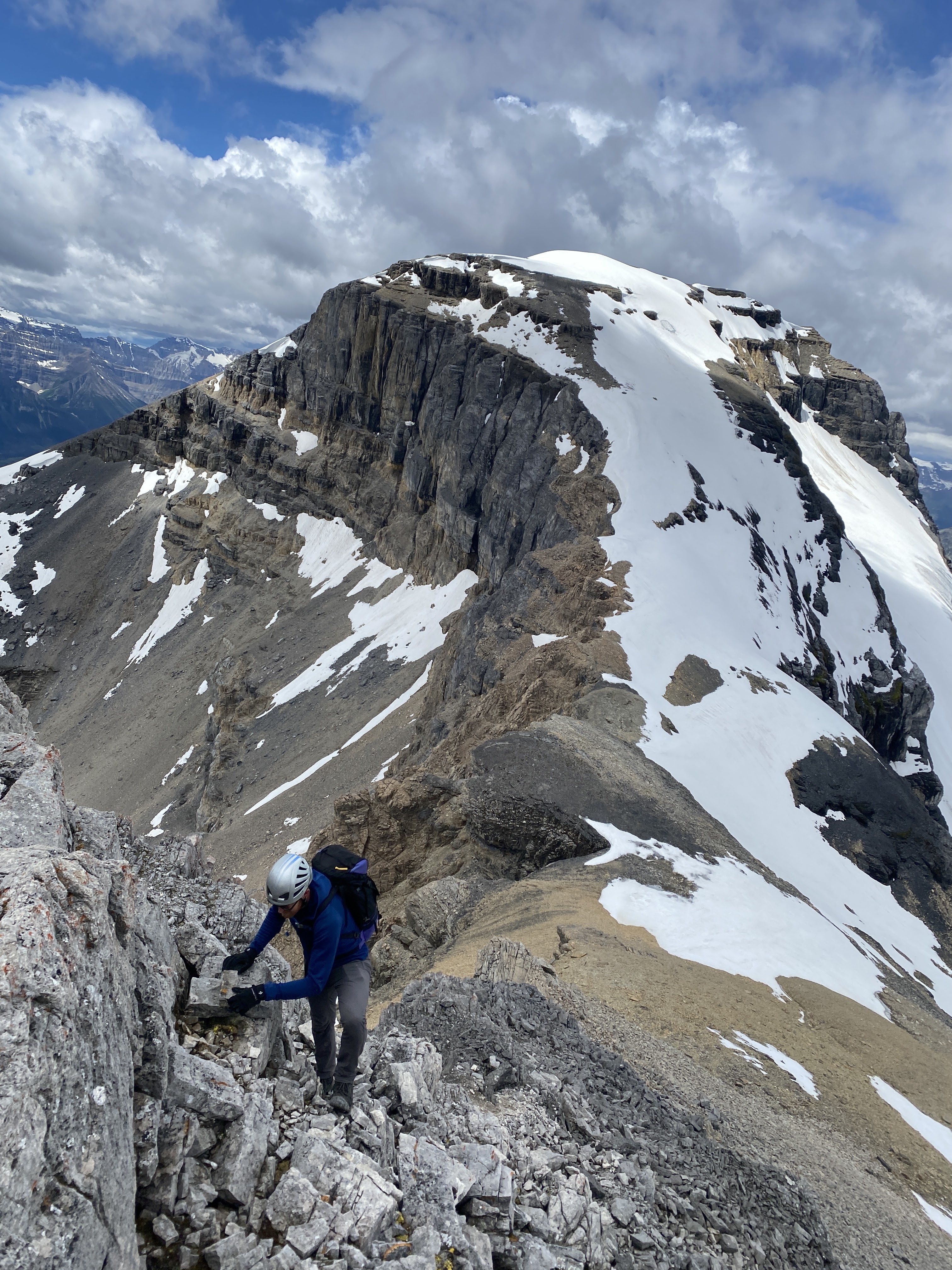
Close up of the summit block of North Cat's Ears.
We will be back.

We were treated to some amazing views traversing the hill and thoroughly enjoying the dramatic lighting. Hard to have a bad day in the Opal Range. 

View to eastern bump on East Opoca

Scott on eastern highpoint of East Opoca.

Hiking to main highpoint.

On the highest point of "East Opoca".


Wednesday, July 30, 2025

“Mount Sarcee” (’Ripsaw')(GR373253) – South Ridge Attempt. 5.7+


View to summit of "Mt. Sarcee" from upper South Ridge.

Mt. Sarcee is an unofficial name applied by David Jones in the guidebook "Rockies South. The Climber's Guide to the Rocky Mountains of Canada: Volume 1" (2020) for this significant peak (GR373253, summit height approximately 3000m) immediately east of Mt. Evan-Thomas. I met with David several times and provided a lot of information for the Opal Range when he was writing this guidebook, he had indicated that Mt. Sarcee was the name preferred and used by local climbing legends Glen Boles and Don Forest. 

View to west aspect of "Mt. Sarcee" from Mt. Hood.
The South Ridge is the right side summit ridge. 

Local hiking guidebook author Gillean Daffern has used the name “Ripsaw” for this summit. Gillean has been writing and publishing trail guides to Kananaskis Country for over 30 years and is the author of the renowned five-volume series Gillean Daffern’s Kananaskis Country Trail Guide, first published in 1979.

Gillean’s name was derived from the extremely jagged saw blade like North East Ridge of Mt. Sarcee. This sharp ridge is visible from highway 40. The name Ripsaw was always applied to the highest primary summit of the mountain. Recently, summer of 2025, the GAIA base map (gps website/app mapping platform for mountain activities) now includes the name of Ripsaw and Mt. Sarcee for two highpoints along the summit ridge. Prior to this, the GAIA map only identified the highest summit as Mt. Sarcee. How, or why, two names are now being applied is unknown to me. Where does GAIA get its data? This is one mountain and one summit, there is no need to apply two names to this mountain. 

GAIA base map. There is no need to apply two names to this mountain.
Our camp sites are indicated by red/black triangles.
 

Monday July 21 Scott Berry and I started our approach to Mt. Sarcee. The weather forecast wasn’t good. Forecast called for heavy rain and high winds starting Monday night and into Tuesday, but clearing overnight with sunny skies and warm temperatures on Wednesday July 23. Based on this forecast our plan was to approach most of the way on Monday and set up a camp and wait for the clear day on the 23rd to attempt the South Ridge of Mt. Sarcee. We biked to the Romulus campground, ditched the bikes and hiked west up the West Fork of the Little Elbow River. A good trail exists for a few kilometres, but soon the Little Elbow River washed out the trail and the bushwack begins. Eventually we decided to camp low in the valley and have a campfire and relax, moving camp to the alpine on Tuesday. This section of the valley has many informal campsites, many with fire rings and logs arranged for seating. Near our campsite we found an old, rusted camp stove, very interesting. 

Biking the Little Elbow road.

Old stove near our camp low in the valley.

Pleasant campsite in West Fork of the Little Elbow River.

Light rain overnight Monday, we moved camp to tree line south of Paradise Pass on Tuesday and the rain came went through out the day. We woke up Wednesday, July 23, and the skies were completely clear. Soon we were plodding up a major scree slope to gain the South Ridge proper. On the upper ridge we did climb 5 pitches of steep and loose climbing, up to 5.8, but mostly 5.6, interspersed with sections of 4 class climbing. After 3 pitches of mostly direct ridge crest, we rapped below the ridge to avoid an incredibly loose section of ridge line. First pitch back to the ridge line was fun and fabulous climbing on fossil blob features with prefect cam protection. The last pitch we did was more loose and exposed ridge climbing. Nearing the summit block, we decided to bail since the final section looked to be very difficult climbing and the day was getting late. The upper summit block accessed from the South Ridge looks quite challenging, maybe 5.9+? The rock quality looked more solid, but protection for climbing also looked difficult. 

View south towards Mt. Tombstone, Cat's Ears and other fabulous Opal summits.
Photo by Scott.

Upper South Ridge of Mt. Sarcee.
Photo by Scott.

View to our first pitch.
Photo by Scott.

OSWB leading up pitch 1.
Photo by Scott.

View to Paradise Pass, Mt. Evan-Thomas on left above pass.
Photo by Scott.

Pitch 2 choss. We both attempted to lead this very loose fin, so, so loose.
We both chickened out on it.
Photo by Scott.

Pitch 3, not really a pitch. I led on the right side, east side, of the ridge, below the loose fin.
Just hard 5.8 climbing with no protection. I bailed.
Photo by Scott.

After bailing on pitch 2 & 3, we rappelled below the ridge.
Photo by Scott.

Only fun climbing on the whole trip.
Below the ridge I climbed a 60m pitch on excellent rock, with easy protection back to the ridge crest.
Photo by Scott.

OSWB retreating from our high point.
Last "pitch" on the ridge crest was 4 class and low class 5,
super loose chossfest that we scrambled.
Photo by Scott.

Photo by Scott.

Back to our tree line camp for Wednesday night. Thursday, we broke camp and hiked back to the bikes and enjoyed the quick downhill ride back to the parking lot. Will be back to explore other routes on this obscure mountain. We had an incredible adventure in a remote location, figuring out our own line up the mountain, just what summer alpine climbing is about. 

View to Paradise Pass from camp.

Hiking out.
View to East Face of Mt. Blane.

Tuesday, July 15, 2025

Pika Peak - South West Slopes/West Ridge Scramble

Hidden Lake views to Pika Peak.

Sunday July 13 had an amazingly fun day on Pika Peak with John. We biked to near Temple Lodge (Ski Louise lodge) and locked up our bikes. Hiked to Halfway Hut and then up the  standard scramble route on Pika Peak. South West slopes side sloping leads to the Pika/Richardson Col. The West Ridge to the exciting final summit ridge is easy/moderate scrambling. Summit ridge is an exposed horizontal cat walk to the protruding bump of the summit. Exposed, but all moderate/easy scrambling IMHO. Lucky the surrounding rain clouds stayed away and we had calm conditions on the summit. Quick return to Hidden Lake and headed back to the bikes. We had rain for our final 30 minutes of walking and our 10 minute bike ride out was very wet. We were under 9 hours car to car. Super awesome day out. 

John at the Halfway Hut. 

Clouds hanging low on Pika and Ptarmigan. 


Gaining elevation towards Pika/Richardson Col. 


View back to Mt. Richardson as we ascend West Ridge of Pika Peak.


Summit ridge, view to summit bump.

Summit bump.


Final steps.

View to the always impressive Mt. Douglas (to the left) and
Mt. St. Bride (on the right). On my wish list to ascend. 
St. Bride (3315m, 10,876ft) was once thought to be an 11,000+ summit. 

Summit register.


The always impressive Wall of Jericho 


Back to the bikes for the quick ride out.