My friend from San Francisco, Scott Berry, is super stoked to climb Opal Range summits, and after our ascents of South Schlee and Little Tombstone in September 2016, Scott was keen to try the couloir on Elpoca. I had never heard of an ascent of this route, and was hoping to set a first ascent. Scott and I were successful on our climb of the couloir and North Ridge (just west below the ridge line) to the summit of Elpoca Mountain on June 26, 2017. Turns out we missed the first ascent by one year, oh well, we had an absolutely spectacular alpine day on our trip.
 |
| North Face and North Couloir of Elpoca Mtn. from near Piper Pass. Great Northern Couloir obvious line on right. Photo taken Sept. 2016. |
Sunday June 25, we did a casual approach and arrived at our
bivy site within 2.5 hours from the busy Elbow Lake parking lot. Perfectly situated underneath the scree
slopes below the great northern couloir in the Piper Creek drainage. Set up camp, did a hike up to the base of
couloir and across scree slopes to gain a better view. Pumped for the early start.Thinking back to the ascent now, I have broken up the ascent
and descent into three sections each.
Ascent sections, The Great Northern Couloir, Scrappy Traverse and the
Rock Pitches (rock steps to gain standard south ridge route, then 5.5 ish
terrain to summit). Descent sections,
south ridge descent, big snow slope (Golden Gully) and scree to trees.
 |
| View to North Face and Great Northern Couloir from camp. Base of couloir snakes right, then left out of sight. |
 |
| Kevin (OSWB) scoping route. Photo by Scott Berry. |
 |
| Zoom to lowest section of couloir. |
 |
| Middle section visible from above camp. We stayed climber's right of the "island" and the "fin" on our ascent. Left side of fin lacked snow on top of fin. |
 |
| View again to couloir. |
 |
| Tent at bottom of this scree slope. Perfect spot. 2.5 hour walk from Elbow Lake, so a day tripping should be doable. |
 |
| View south from kitchen near camp. |
The Great Northern Couloir
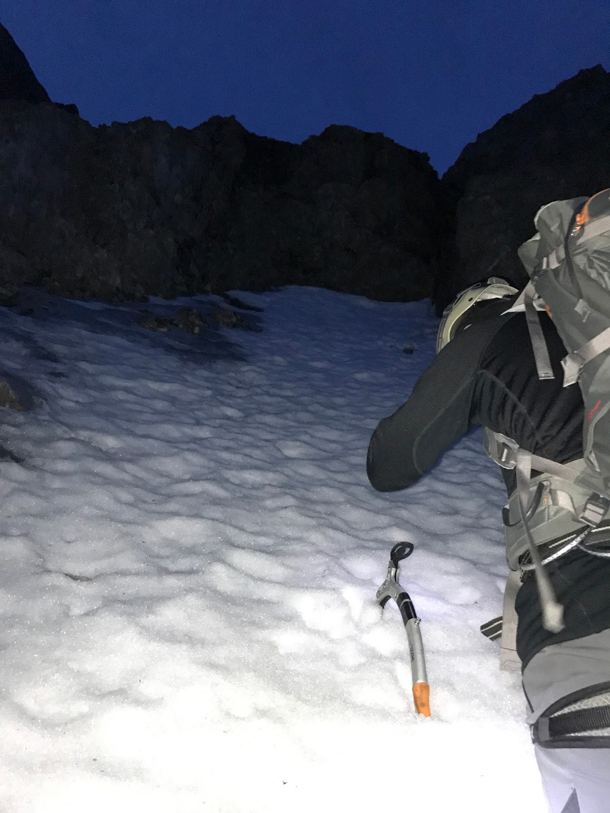
Relatively straightforward snow plod to summit ridge, but not to be taken lightly. About 350 metres of gain, slope steepest at about 50 degrees, but lots of potential for rock fall. Would recommend ascending all the snow in the dark. We started on the snow about 2am and ran out of snow, very close to North Ridge, about 4:30am. We solo’ed the snow slope, didn’t use a rope or any snow pro. We did use two technical axes and wore crampons for the ascent. Exit to our chosen low point on the ridge required some moderate mixed snow/ice/rock climbing to hit the saddle, did set a solid picket anchor to belay this pitch. About 50 metres to gain ridge. Our original plan was to gain the proper North Ridge as soon as possible, but the couloir exit had near vertical walls above and any rock exit to gain the ridge proper would be difficult, I would guess at the lowest 5.9 or even 5.10, with no easy protection. May have been easier exits part way up our mixed pitch, but no obvious line, so we gunned for the low point on the ridge.
 |
| Scott pumped to run up this thing! (also worrying about rockfall) At the narrow section at beginning of couloir. |
 |
| Almost out of snow, very near the start of mixed exit pitch. |
 |
| View down from near mixed pitch, sun starting to give us some light. |
 |
| Just above mixed pitch, easy terrain to gain low spot on North Ridge. |
 |
| Sunrise views north to Mt. Jerram (l) and Cats Ears (r, double summit). |
 |
| More cool morning light. |
Scrappy traverse including, manky ledge below summit block
We were both happy to be on the ridge and out of the serious rock fall hazard zone before the sun was fully up. We had a quick breakfast break and picked an easy looking line that would keep us about 70 metres below the highest ridge line we could see. The majority of this next section was moderate terrain with a mix of scrambling loose rock, small snow slopes and a raising ascent line that would drop a bit into a gully system, then up over a rib to gain another gully edge, then repeat a few times. This travel was quick and we were unroped. Didn’t know it at the time, but we reach a traverse ledge below an overhanging wall, this ledge was directly below the summit block. This traverse ledge also had a very exposed overhanging/vertical drop beneath it. We did belay across this ledge since it was so loose and any fall would be very unforgiving. At the end of this ledge traverse was a short, but steep, rock step, our crux.
 |
| View to gain skyline North Ridge. Looked loose and tough. We bailed to easy ground below ridgeline, on the west side. |
 |
| Just leaving our low ridge point, starting traverse south. Photo by Scott Berry. |
 |
| Start of traverse, typical terrain for first half of traverse, up and over a few ribs. Unroped and straightforward terrain. |
 |
| Scott enjoying the views to the west. |
 |
| View up to ridgeline above. |
 |
| "Mt. Roberta" to west. Photo by Scott Berry |
 |
| Outlier tower and Gap Mtn. Photo by Scott Berry |
 |
| Nearing end of the traverse, start of manky ledge below summit block. Photo by Scott Berry |
 |
| Scott crossing manky ledge. He is likely directly below the summit at this point. Our crux, the 5.8 ish step, is at the end of this ledge. Our exit was just left of the small nub on the skyline. |
The Rock Pitches
As is often the case, the rock step didn’t look that bad, but it was solid 5.8, or maybe even 5.9, on downsloping ledges with very little protection available. Glad Scott was keen on this pitch. He did a fantastic lead and placed all our skinny pitons (knifeblades and bugaboos), I think about 10 pins and a few wires. About 40 metres from belay to belay. The top of the step put us very near the final section of the south summit ridge route. Above this station was another pitch of solid 5.7 climbing to gain an in place anchor station.
 |
| View across mank ledge to crux pitch. |
 |
| Base of crux pitch. Didn't take enough pics. Solid 5.8/5.9 downsloping ledges to belay. Basically up the middle to the notch left of the nub. Scott's fine lead. Photo by Scott Berry |
 |
| Kevin on second of crux pitch. Photo by Scott Berry. |
 |
| Kevin heading up 5.7 pitch. Photo by Scott Berry. |
 |
| Summit pointy bit upper right. Our manky traverse was just below the big overhand. |
 |
| Kevin at an intermediate station. Ditched my pack here.Summit over my shoulder. Photo by Scott Berry. |
 |
| Nearing downclimb crux of south ridge, near summit block. Photo by Scott Berry |
 |
| Cruxing. Wind was whipping the shit out of the rope. Photo by Scott Berry |
 |
| Scott B. rocking the summit of Elpoca Mtn. |
 |
| Final steps to summit for KB. The absolutely gorgeous Elpoca Tower below. Photo by Scott Berry |
 |
| Boys on top. Photo by Scott Berry |
 |
| Summit register entries. |
 |
| Our summit entry. |
 |
| Tombstone summits from summit. |
 |
| Elpoca Tower. |
 |
| Rappelling off of the single summit bolt. Photo by Scott Berry. |
South Ridge Descent
Overall not too bad, but the thunderstorm and not having ascending it made the final exit more problematic. We rapped off the single summit bolt. Scott ran to the fixed station, belayed me, then we returned to first fixed station we found, rap, then more downclimbing, another rap, then a bit of confusion, wasted some time finding another an easy downclimb, couldn’t but eventually found another rap station. Trying to figure when the top of the snow slope, aka the Golden Gully was a bit confusing, then we got hammered by a thunderstorm complete with hail, good times. Eventually found the top of the Golden Gully after slogging up hill to a little smooth saddle.
 |
| Old man Barton at rap station. Photo by Scott Berry |
 |
| View back to summit ridge. |
 |
| Kevin down climbing near last rap. Photo by Scott Berry |
 |
| Last tricky rap. Photo by Scott Berry |
 |
| Post thunderstorm. The end is in sight. The top of the "Golden Gully" is visible, just left of the biggest snow patch. Photo by Scott Berry |
 |
| Approaching the exit slope, just left of the big snow patch. Photo by Scott Berry |
Big snow slope (Golden Gully)
This is access up the East Face to the South Ridge, famously
named the “Golden Gully” by Orvel Miskiw. Highly recommend that if you ascend
Elpoca, and this slope, do it when this slope is covered in snow. Other reports of ascending and descending
this rock/scree slope sounds miserable.
I prefer kicking steps in snow.
This slope is also long with a lot of vertical gain/loss, we had snow
from the ridge, all the way to Elpoca Tower, about 300 metres. Simple snow
descent. We had another thunderstorm hit us on our descent of this snow slope,
very cool echoing surrounded by the big walls.
 |
| View down big snow slope (golden gully). |
 |
| OSWB near slope of big snow slope. Photo by Scott Berry |
 |
| The luscious Elpoca Tower and the left trending snow slope (golden gully) heading to the ridgeline. Photo take on our exit hike. Regards my friends. Long life. |
Scree to trees
From Elpoca Tower back to tree line above the Elbow River
was a simple hike, but, after the long day, this section seemed to take
forever. Beautiful sunny conditions as
we hiked across the meadows north of the Elbow River to find the trail back in
Piper Creek and back to camp. All in, we
were about 20 hours camp to camp. Super happy to have finally climbed this cool
looking line. Great times with an impeccable
climber. Scott and I had a blast.
 |
| A very approximate line of our ascent. Photo from highway 40, near Elpoca Creek. |