Wednesday, August 7, 2024

Mt. Peter - South West Ridge/North West Face Scramble


Great road side camp with great views.

Fabulous day out with the intrepid Steve on Mt. Peter in the Purcell Range. To avoid potential thunderstorms on Monday afternoon, we pitched a tent Sunday night on the Farnham Creek FSR to allow for an early start. Our road side camp has great views to the Commander Glacier. Moving before first light on Monday August 5, we made great time on the trail to the South West Ridge. 

Very well defined trail for the scramble route start off the FSR.
I think a famous YouTuber may have put in this excellent trail.
Thanks Forest!

Typical slog from creek to gain lower 
West/South West Ridge.

Cloud and dark skies to the west.

Lots of scree slogging to gain the interesting scrambling on the solid quartzite cliff band at the top of the ridge. As the ridge steepens, traverse to the upper North West Face to gain the easy North East Ridge to make the summit. A little glacier exists on the upper North West Face. 

As you gain elevation, the South West Ridge 
becomes more solid and less of a slog.

High up on the SW Ridge a 5 class nose bars easy travel.
I am sure this goes as a 5.8? route, but we traversed north
to easy terrain on the NW Face.

Traverse to NW Face, small glacier and great views to 
Mt. Farnham (right) and Mt. Hammond.
Both 11,000'ers.


Slog up final NW Face to North East Ridge.

Easy hike up final North East Ridge to the summit.

Great summit views and the weather start to improve. Enjoy the summit and reading the register. Easy hike back to the lower North West Face. On the descent we used a snow/ice ramp to avoid some of the nasty wet down climbing we did on the ascent. Incredible views to the surrounding mountains. Weather improved throughout the day with skies clearing as we descended. Awesome day out on a fabulous Purcell 11,000’er.

Steve checking out the summit register.

Summit posers.

OSWB on the summit of Mt. Peter.
(Photo by Steve)

Our summit register entry.

Famous people in register. 

We did a short fun snow/ice climb up on the descent.
It allowed us to avoid a very wet section of scrambling the rocky ridge.
And it was fun and scenic. 

A few tricky steps on the South West Ridge descent. 

Warm sun and improving views on the descent. 

Wednesday, July 31, 2024

Mt. Engadine - North West Ridge Scramble

July 26 Scott and I were back at the Mt. Barham/The Blade Col. Took a new line, way left of our attempt last summer, but again the steep slab shut us down with 5.9+ unprotectable climbing. We returned to our front country campsite to regroup. July 27 we needed a simple and easy day and chose the North West Ridge of Mt. Engadine. Fun easy day out with interesting scrambling and a good cardio workout. Just under 7 hours car to car. Great views and nice to tag a summit. 

View to Mt. Engadine at the end of the day. 

Big slab below The Blade / Mt. Barham col.
Difficult to protect and all 5.9+ lines. 

Back at camp dealing with defeat.

Onto the fun NW ridge of Mt. Engadine. 

View to the top of Mt. Engadine.

Enjoyable hiking and scrambling. 

Some fun sections. 

Scree slog after fun ridge.

View to the summit.

Scott's final steps to the pinnacle. 

High cloud views.

Summit posers.

Summit register.

Summit entry.

Cool lines, interesting gullies and steep ridges on 
"Mount Buller - West Peak"

Sunday, July 28, 2024

“Cat’s Ears" (GR385179) - South Summit - West Face, 5.6 Alpine III


View from Opal Creek to the "Cat's Eats".
South summit is the right summit.

July 22 Scott Berry and I were successful on our climb of “Cat’s Ears” (GR383179). We had attempted this peak last year, but didn’t figure out the route description. We climbed the West Face of South Cat’s Ear on the Don Forest/Gene Fraser route (1981), or close to it. The upper mountain, once at the col between the two Cat’s Ear, is a series of steep loose gullies, with steps of varying rock quality up to 5.6/5.7. A truly scary choss fest. The final pitch to the summit was fun 5.6 on solid rock with great pro. Not all the 5.6 climbing was as high quality. Incredible views from the summit ridge. Two high points on the summit ridge. Both appeared to have cairns, but I carefully disassembled both and found no register. I left a new summit register and book. Based on my research, our ascent is the second ascent. A stunning summit, but hard climbing on loose terrain, not an easy day for sure. Super happy to reach this elusive summit. 


more details to come ... 

Monday, July 15, 2024

Wasootch Peak. North to south traverse


View to Mt. Lorette. 

On Friday July 12, after a full day in the office and feeding the family dinner; last minute I decided on a quick bike n hike. Parked at the regular parking spot for Wasootch Peak, rode my bike about 4 kilometres north and hide my bike in the bush. Bush bashed up the north ridge of “Wasootch North Peak”. Fun scramble once above tree line. Great evening light and a cool breeze in the alpine. Great hike from the north peak to the main Wasootch Peak. Haven’t been in the hills much recently, so I pushed the pace and was happy with a car to car of 3 hours 15 minutes. Good times. 


Thursday, February 15, 2024

Ceramic Engineer - 70m, WI3

Anyone ever hear of the ice route “Ceramic Engineer “.  Probably not. I am approaching 30 seasons of ice climbing and have never heard of anyone climbing this route. Haven’t been out at all this season and was looking for an easy WI3 route. Ceramic Engineer 70m, WI3 is in Jo Jo’s guidebook and seemed like a reasonable day out. It is just east of Mt. Wilson, about 6 km east of Saskatchewan Crossing in Owen Creek. 

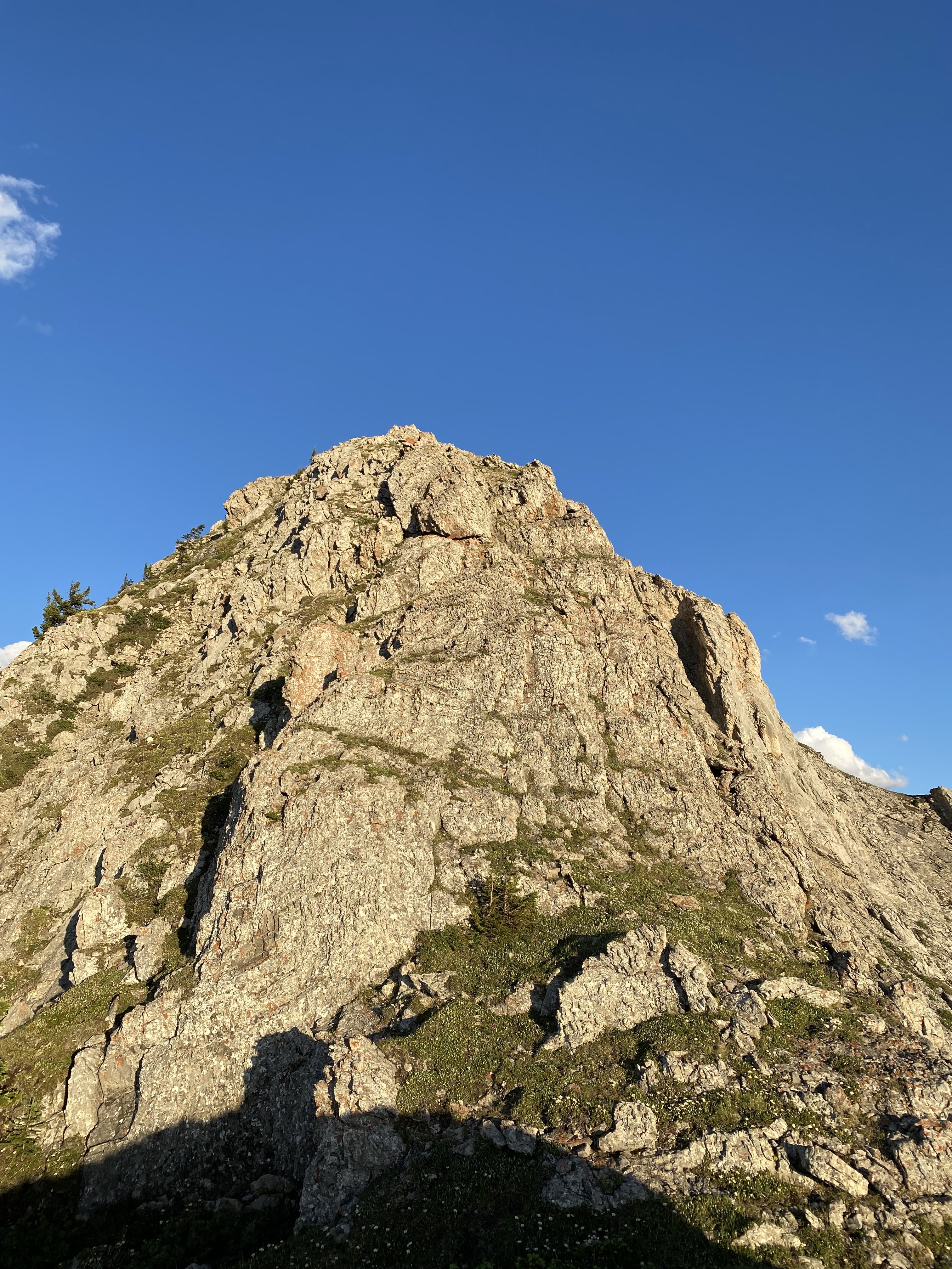
From the creek, view to the route.

First view to WI5 up on cliff band.

We see some ice. 
John spied the WI5 pillar.
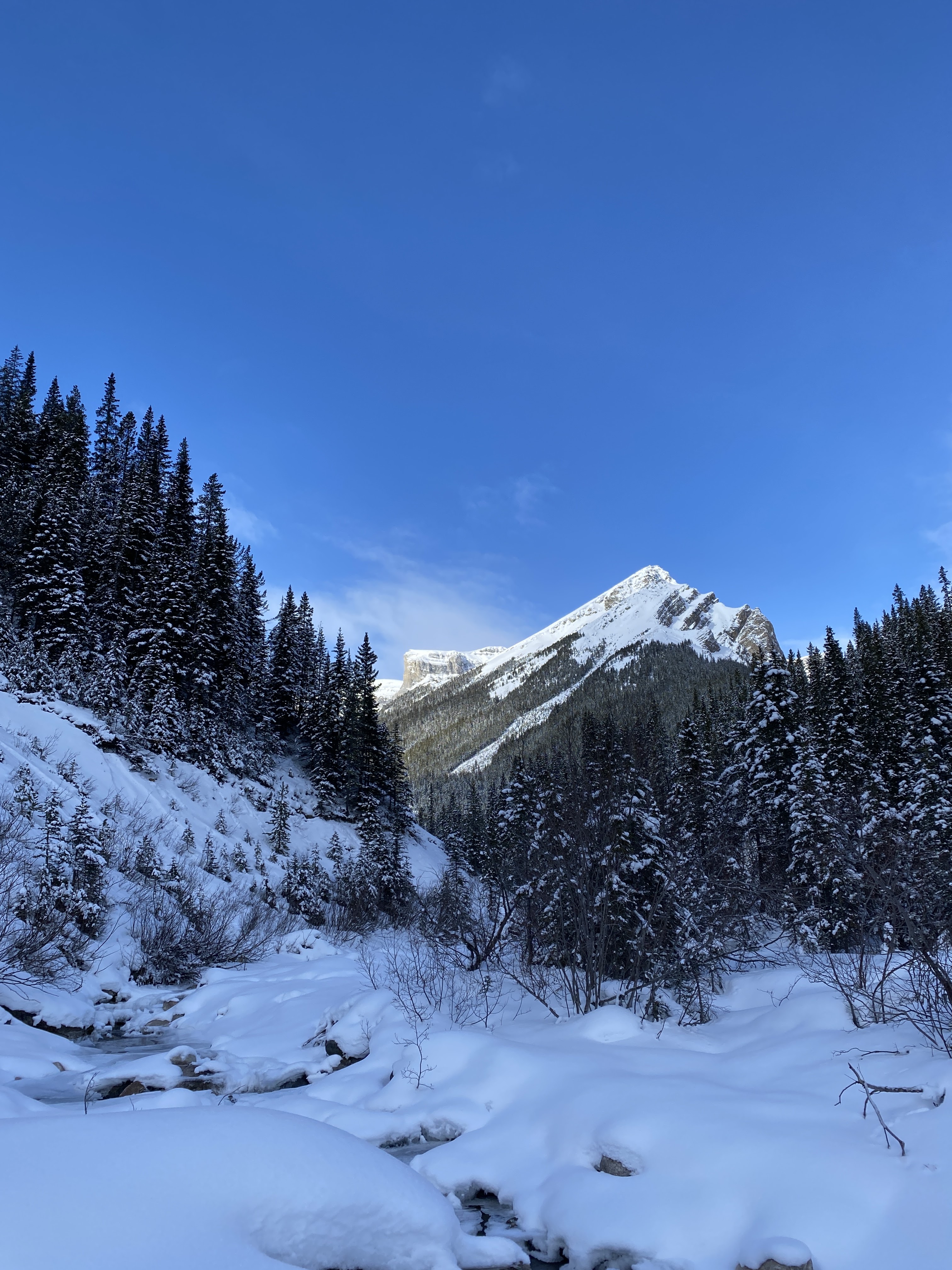
View up Owen Creek.
Nice little valley.

Hiking up to the WI3 route we climbed.

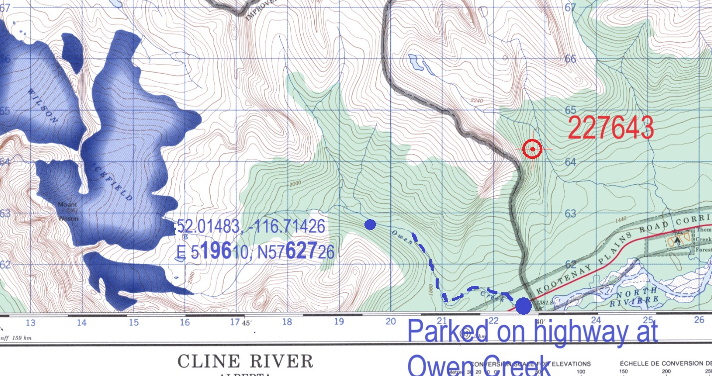
Reviewing the information provided in Joe Josephson's "Waterfall Ice: Climbs in the Canadian Rockies", there is some incorrect UTM numbers provided for Ceramic Engineer. The guidebook description is shown below, the UTM grid provided for Ceramic Engineer is 227643. Ceramic Engineer is in Owen Creek, the guidebook also lists three routes in Thompson Creek, and provides a UTM grid of 227644; only 10 metres apart. Not correct since these creeks are kilometres apart. My reading from the route we climbed is shown below on the map below, UTM grid 196627. I am assuming we climbed Ceramic Engineer, even with only about 45 metres of climbing. The route is in a gully, so some years would have more ice for sure. 

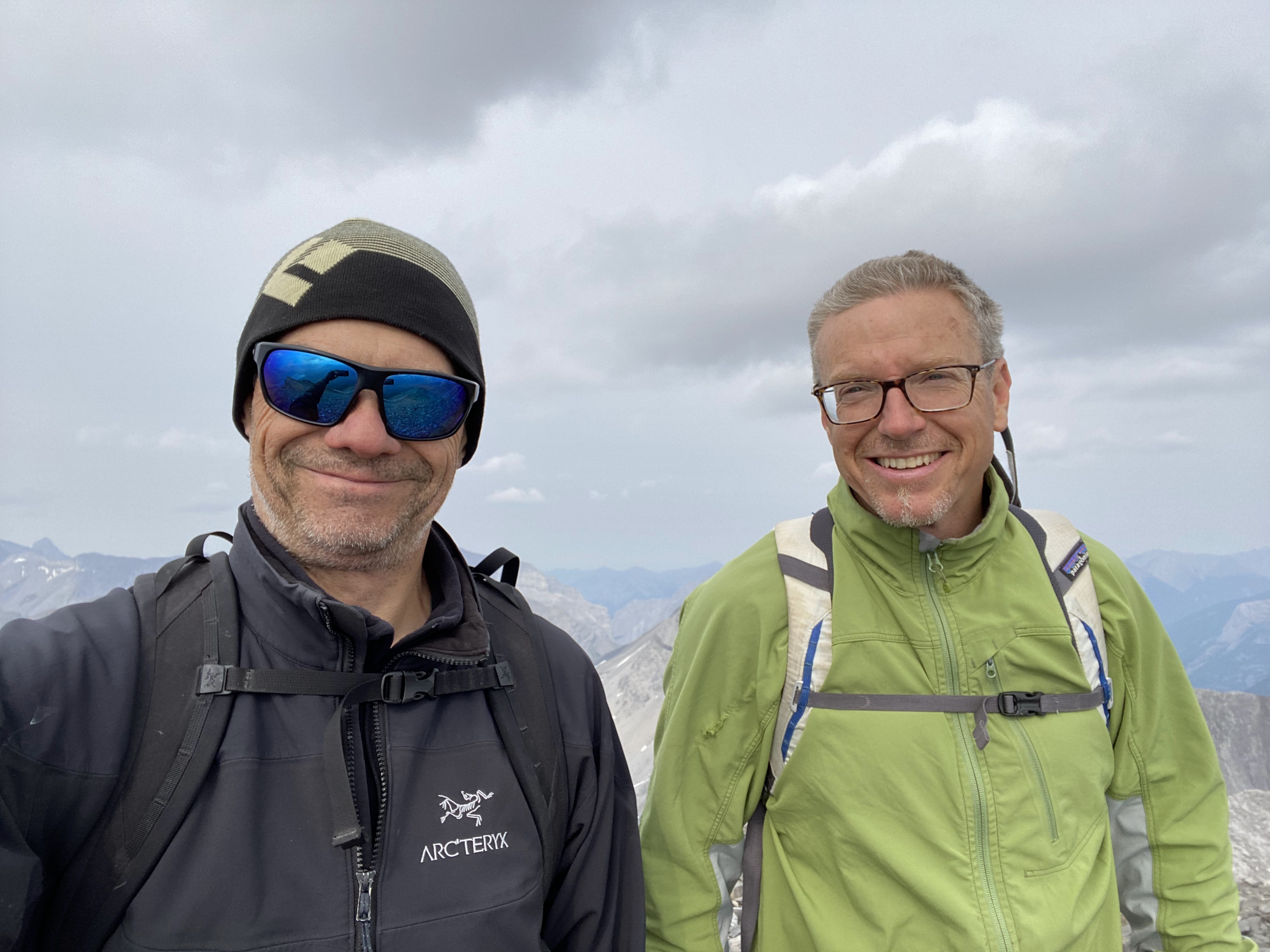
I convinced John it was a good idea so we headed there on Saturday Feb. 10. After hiking in almost 5 km we saw some scary sun affected WI5 ice. We hiked a bit and found a 45m WI3 route. Climbed it, not sure it was Ceramic Engineer?  Was a great day out with a great bud in remote setting. Tons of fun.


Blue dot is the WI3 route we climbed. 

UTM grid of 227643 would be in Thompson Creek.

Map in Jojo's excellent guidebook.

View down from my first screw placement.
Route was the most steep off the deck.

John pulling the ropes after our rap off a tree at the top.