Great
spring training day out. Two summits in
just over 5 hours, not bad for an old guy on a solo, near birthday, trip. Great weather and the need for some time on
my feet took me to these two fun little peaks at the north end of the Kananaskis
Valley. Midnight Peak (GR379494) and Midday Peak (GR385487) are in between the
busy and popular Mt. Baldy scramble/traverse and the peaks at the end of the
long McDougall Ridge; “Wasootch Peak” and “Kananasksi Peak”. Midnight and Midday Peaks are in dry front range,
making them great for shoulder season ascents, and have a short approach on a
great trail.
 |
| From summit of "Midday Peak" looking north-west to summit of "Midnight Peak". |
Parked
as the Baldy Pass trail, quick pace up the trail quickly leads to Baldy Pass,
about 50 minutes with a quickish pace. I had limited time, so I took the easy
and fastest approach, Baldy Pass trail to the pass was the quickest option.
From the pass I took the scrambler’s trail towards the summit of Midnight Peak,
but in the trees above the pass, there was a fair amount of snow and ice still. After a few pockets of deep snow and post
holing, arrived at tree line and was mostly able to stay out of the snow.
 |
| Mt. Lorrette on the approach trail. |
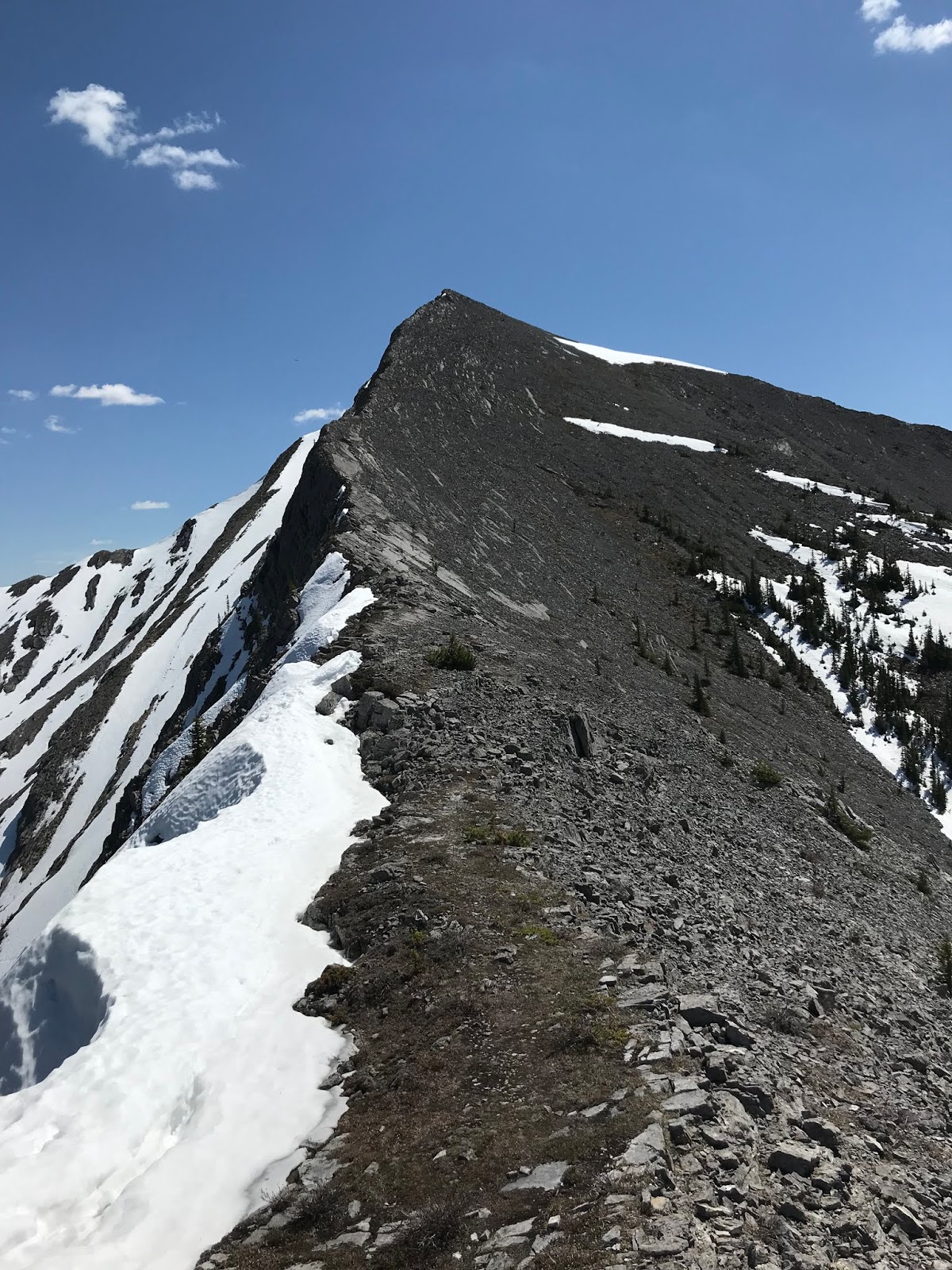
 |
| West Ridge of Midnight Peak from Baldy Pass trail approach. |
 |
| Patches of deep snow and ice in the tree above Baldy Pass. |
 |
| End of snow at tree line, scree slopes to summit ridge. |
 |
| View back to Baldy Pass from tree line snow. |
 |
| Near summit snow patch, view down to Baldy Pass. |
After a
quick diversion up and then out of a deep snow patch below the summit, I changed
course to get out of the deep snow and gained the north west ridge below the
summit, then hiked to the top. Slowed a
bit by deep snow, easily arrived at the summit in 2 hours. Big summit cairn,
but no summit register.
 |
Snow patch below summit, I followed an old track into the snow patch; bad call.
Turned to a post hole wallow, retreated to scree slope and headed more west to get out of the snow. |
 |
| Once past snow patch, gained the easy west ridge, simple hike to the top. |
 |
| Summit selfie on summit of "Midnight Peak" |
 |
| View from summit of "Midnight Peak" to col and beyond to "Midday Peak". |
Enjoyed
the pleasant view, then headed straight down the ridge to the col between the
peaks. Up the north west ridge direct from the col towards the summit of Midday
Peak, could be called moderate scrambling? A wee bit of exposure on the ridge,
but I used my ski poles the whole way, no hands on rock. The walk over to
Midday Peak was quick, and reached my second summit in about 20 minutes from
Midnight Peak. There was a new register
on the summit, but it was a poor choice for the container. A small mouth soft
plastic water bottle. The narrow mouth
is really hard to get the writing pad in and out of the bottle, and the soft
plastic will eventually get eaten by rodents.
Enjoyed the view and scoped out the nice looking line from Midday Peak
to Tiara Peak, looks like a fine ridge walk.
Quick plod back to Midnight Peak.
 |
| From col, view back to Midnight Peak. |
 |
| From col, view to Midday Peak. |
 |
| A snowy looking Mt. Bogart. |
 |
| Summit selfie on "Midday Peak". |
 |
| Summit of Midday, view back to Midnight. |
 |
| View back to Midnight and Mt. Baldy. |
 |
| Super poor choice for a summit register. |
 |
| Hike back to col, view down to col. |
 |
| View back up to Midday Peak |
 |
| Another view up, closer to the col, to Midday Peak. |
On
descent, I took a short cut, based on web trip reports, many parties take a
variety of lines up and down Midnight Peak, lots of easy/moderate options from
the approach trail. I spied a trail in
the scree in the drainage just west of pass trail. Using the same slope below
the summit as on the ascent, headed slightly west into the drainage was able to
avoid the icy and snowy tree trail above the pass. Fun, easy day out, 5 hours
car to car.
 |
Midnight and Midday Peaks with nearby summits.
My route up shown by red line, descent in blue and approach trail in orange. |
 |
From just below summit, view to Baldy Pass, thin line of no trees near centre of photo,
and view down to the drainage I descended. |
 |
View to drainage further west of the one I took. This drainage is visible from the approach trail.
I think there are a few steeps steps with this line, in order to be quick, I took the other drainage. |
 |
| Sub ridge dividing the drainages. |
 |
| Nearing the scree trail in my descent drainage. |
 |
| View up the drainage I did not descend. I am sure it would work as a route for ascent and descent. |


No comments:
Post a Comment